Old Maps of Central, Alaska for Academic Research
Study the evolution of Central with 5 high-resolution historic maps. Whether you're teaching, researching, or modeling changes in land use, these maps provide essential visual documentation of urban, environmental, and geographic change.
- Analyze long-term change: Track patterns in development, transportation, and natural features.
- Ideal for environmental or urban studies: Support academic projects with primary historical map data.
- Use in the classroom or lab: Educators and researchers rely on these maps to bring historical context to life.
These maps are a powerful tool for teaching, research, and visualizing how Central has changed over the decades.
Central, AK maps
(5)- 1951 Map of Circle, 1952 Print
 1951 Circle1952 Print · USGSThe Steese Highway corridor in the early fifties reveals a landscape of mining camps and geothermal outposts. Trace the route through Eagle Summit to find Central House, Circle Hot Springs, and numerous Placer Mines along the creeks.4 unique versions available
 - 1955 Map of Circle C-2, 1959 Print
 1955 Circle C-21959 Print · USGSMid-century interior Alaska is shown here during a period of active gold prospecting and remote settlement. Trace the legacy of northern mining through features like the Placer Mine, the isolated Cabin structures, and the namesake Graveyard Creek.3 unique versions available
 - 1955 Map of Circle, 1961 Print
 1955 Circle1961 Print · USGSInterior Alaska in the mid-1950s is defined here by the Steese Highway and the remote outposts it connected. Researchers can trace early roadhouses and mining infrastructure at Miller House (PO), Twelvemile House, and the Placer Mine sites.8 unique versions available
 - 1964 Map of Circle
 1964 Circle1964 Print · USGSThe Alaskan interior at the height of the mid-century wilderness era is defined here by the river-fed settlements and high mountain passes. Researchers can trace the path of the Steese Highway to Circle, finding remote sites like Circle Hot Springs and Miller House.
 - 2018 Map of Circle C-2 SW, 2018 Print
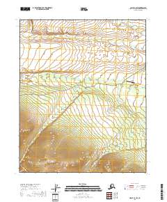 2018 Circle C-2 SW2018 Print · USGSThe Yukon-Koyukuk wilderness in the 2010s remains a landscape of rugged aviation and remote drainages. Researchers can trace transportation routes like Circle Hot Springs Road and locate distinctive water features such as Graveyard Cr and Louie Pup.
End of results
Showing maps 1-5 of 5
Frequently asked questions
- What are the different types of historical maps available for Central?
- What is the oldest map of Central?
- Where can I purchase historical maps of Central for my home or office?
- Where can I download high-res historical maps of Central?
- Are there historical topographic maps available for Central?
- Is there historical aerial imagery available for Central?
- Where are historical maps of Central sourced from?