1951 Map of Circle
USGS Topo · Published 1952About this map
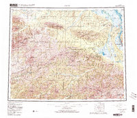
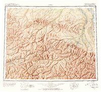
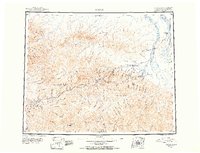
Steese Highway serves as the primary artery through this interior landscape, connecting remote outposts and gold-bearing drainages. The map highlights the early infrastructure of the region, anchored by roadside stops such as Miller House and Central House, while the presence of Twelvemile House (Abandoned) marks a shifting pattern of habitation. High peaks like Mastodon Dome and Chena Dome overlook a network of creeks—including Hope Creek and Faith Creek—where Placer Mines indicate the area's mining history. The importance of geothermal resources is evident in the identification of Chena Hot Springs and Circle Hot Springs, which remained significant landmarks for travel and recreation in this portion of the White Mountains.
Find a feature on this map
75 named features on this map. Tap any name to fly to it.
Don’t see what you’re looking for? This feature index may not catch every label — zoom into the map to look around manually.
Map Details
Editions of this 1951 Circle Map
4 editions found
Historical Maps of Circle Through Time
3 maps found