
1950 Map of Fairbanks
USGS Topo · Published 1955About this map
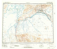
The interior of Alaska during the early Cold War era is defined by the massive military presence of the Ladd Air Force Base Bombing and Gunnery Range and Eielson Air Force Base. Centered on Fairbanks, the map illustrates a landscape where traditional gold-era infrastructure meets mid-century defense needs. The Alaska Railroad and Richardson Highway provide the primary arteries through the river-dominated terrain of the Tanana River and Tolovana River valleys. Remote settlements and seasonal activities are visible through labels for a Logging Camp and various Placer Mine sites, while older transportation methods persist on the Sled Road network. This survey captures the transition from a mining-focused frontier to a strategic military hub, featuring aviation landmarks like Weeks Field and the Murphy Dome.
Find a feature on this map
84 named features on this map. Tap any name to fly to it.
Don’t see what you’re looking for? This feature index may not catch every label — zoom into the map to look around manually.
Map Details
Editions of this 1950 Fairbanks Map
2 editions found
Other maps of this area

1945 · Livengood
USGS Topo · 1:250,000

1948 · Kantishna River
USGS Topo · 1:250,000

1949 · Fairbanks D-1
USGS Topo · 1:62,500

1949 · Fairbanks D-2
USGS Topo · 1:62,500

1949 · Big Delta B-6
USGS Topo · 1:63,360

1949 · Fairbanks B-5
USGS Topo · 1:63,360

1949 · Fairbanks C-1
USGS Topo · 1:63,360

1949 · Fairbanks D-3
USGS Topo · 1:63,360

1949 · Big Delta C-6
USGS Topo · 1:63,360

1949 · Fairbanks D-4
USGS Topo · 1:63,360