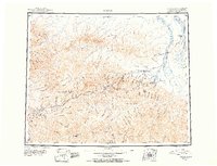
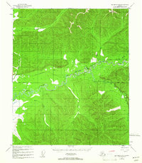
1951 Map of Circle
USGS Topo · Published 1954About this map
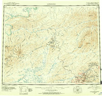
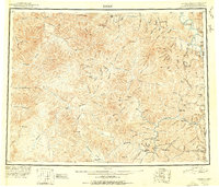
The Yukon River defines the northeastern boundary of this 1951 reconnaissance, where the settlement of Circle stands as a gateway to the Alaskan interior. The landscape is dominated by the White Mountains and Crazy Mountains, terrain that shaped the path of the Steese Highway. This vital artery connects remote outposts like Central and Miller House while navigating high passes at Eagle Summit and Twelvemile Summit. Mining history is evident throughout the drainage basins of Birch Creek and the Chatanika River, with numerous Placer Mines located near Mastodon Dome. The map also highlights the geothermal significance of the region, featuring both Circle Hot Springs and Chena Hot Springs, which served as important landmarks and stopovers for travelers and prospectors alike. The presence of the Twelvemile House (Abandoned) offers a specific data point for historians tracking the shifting settlement patterns and transportation stops along the old highway routes during the mid-century.
Find a feature on this map
61 named features on this map. Tap any name to fly to it.
Don’t see what you’re looking for? This feature index may not catch every label — zoom into the map to look around manually.
Map Details
Editions of this 1951 Circle Map
4 editions found
Other maps of this area
1945 · Livengood
USGS Topo · 1:250,000
1949 · Fairbanks D-1
USGS Topo · 1:62,500
1950 · Fairbanks
USGS Topo · 1:250,000
1950 · Big Delta
USGS Topo · 1:250,000
1950 · Big Delta D-6
USGS Topo · 1:63,360
1951 · Big Delta
USGS Topo · 1:250,000
1951 · Fort Yukon
USGS Topo · 1:250,000
1951 · Charley River
USGS Topo · 1:250,000
1951 · Eagle
USGS Topo · 1:250,000

1951 · Black River
USGS Topo · 1:250,000