Old Maps of Charlieskin Village, Alaska for Metal Detecting
Plan your next treasure hunt with 7 historic maps of Charlieskin Village. Find old homesites, ghost towns, trails, and gathering spots that may be lost to time — perfect for identifying promising metal detecting locations.
- Locate forgotten sites: Uncover places like long-lost settlements, abandoned rail lines, or gathering spots.
- Plan better hunts: Use map overlays combined with LiDAR or satellite views to narrow in on historically rich areas.
- Made for detectorists: Thousands of hobbyists use these maps to discover relics, coins, and hidden history.
Use these historic maps to boost your research and find new opportunities beneath the surface of Charlieskin Village.
Charlieskin Village, AK maps
(7)- 1950 Map of Nabesna, 1954 Print
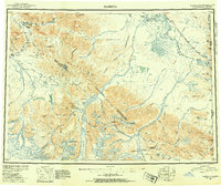 1950 Nabesna1954 Print · USGSInterior Alaska in the early fifties shows a rugged transition from mountain glaciers to river-basin settlements before statehood. Researchers can trace the remote mining outposts of Nabesna and Chisana or locate old airstrips like Reeve Field and Northway Landing Field.4 unique versions available
 - 1951 Map of Nabesna
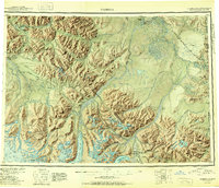 1951 Nabesna1951 Print · USGSThe Alaska interior comes into focus during the early fifties, showing the vast Tetlin Indian Reservation and the rise of bush pilot culture. You can trace the routes of the Alaska Highway and find remote camps like Indian Pass Inn or Chisana.3 unique versions available
 - 1954 Map of Nabesna D-2, 1958 Print
 1954 Nabesna D-21958 Print · USGSSoutheast Fairbanks during the mid-fifties shows the traditional settlements of the interior meeting the new infrastructure of the Cold War era. Researchers can trace the Alaska Highway corridor past Nabesna Village, Indian Village, and the Aboveground Pipeline.
 - 1955 Map of Nabesna D-2, 1965 Print
 1955 Nabesna D-21965 Print · USGSTraditional villages and mid-century infrastructure meet along the Nabesna River in the 1950s. Genealogists and historians can locate Northway Indian Village, the Indian Cemetery, and the original Alaska Highway corridor.2 unique versions available
 - 1960 Map of Nabesna, 1966 Print
 1960 Nabesna1966 Print · USGSEastern Alaska's interior at the dawn of the sixties shows a landscape of remote indigenous villages and highway outposts. Genealogists and historians can locate Northway Indian Village, the Seaton Roadhouse, and mining history at Nabesna.5 unique versions available
 - 2016 Map of Nabesna D-2 NW, 2016 Print
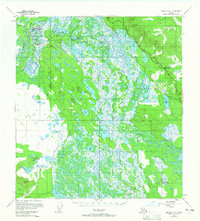
 2016 Nabesna D-2 NW2016 Print · USGSCovers Charlieskin Village, including Northway Village, Northway, and other nearby areas
 - 2023 Map of Nabesna D-2 NW, 2023 Print
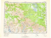
 2023 Nabesna D-2 NW2023 Print · USGSThe upper Tanana Valley area near the Canada-Alaska border is shown here during a period of modern mapping that preserves traditional settlement locations. Genealogists and researchers can locate Northway Village, Charlieskin Village, and the Indian Cem alongside the winding Nabesna River.
End of results
Showing maps 1-7 of 7
Frequently asked questions
- What are the different types of historical maps available for Charlieskin Village?
- What is the oldest map of Charlieskin Village?
- Where can I purchase historical maps of Charlieskin Village for my home or office?
- Where can I download high-res historical maps of Charlieskin Village?
- Are there historical topographic maps available for Charlieskin Village?
- Is there historical aerial imagery available for Charlieskin Village?
- Where are historical maps of Charlieskin Village sourced from?