
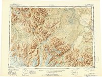
1951 Map of Nabesna
USGS Topo · Published 1951About this map
The Tetlin Indian Reservation occupies a massive central corridor of this interior landscape, where the Tetlin River and Nabesna River weave through an intricate network of lakes and marshes. Early road infrastructure is established along the northwestern corner with the Tok Cutoff and Glenn Highway, providing access to remote outposts like Indian Pass Inn and the Bear Cub Inn. This era highlights the reliance on bush aviation, evidenced by Northway Landing Field and Reeve Field.
Find a feature on this map
109 named features on this map. Tap any name to fly to it.
Don’t see what you’re looking for? This feature index may not catch every label — zoom into the map to look around manually.
Map Details
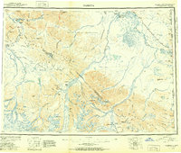
Editions of this 1951 Nabesna Map
3 editions found
Other maps of this area

1948 · Tanacross A-6
USGS Topo · 1:63,360

1948 · Tanacross A-3
USGS Topo · 1:63,360

1948 · Tanacross A-4
USGS Topo · 1:63,360

1948 · Nabesna C-6
USGS Topo · 1:63,360

1948 · Nabesna D-5
USGS Topo · 1:63,360

1948 · Tanacross A-5
USGS Topo · 1:63,360

1949 · Tanacross
USGS Topo · 1:250,000

1949 · Nabesna D-6
USGS Topo · 1:63,360

1949 · Tanacross A-5
USGS Topo · 1:63,360

1949 · Gulkana C-1
USGS Topo · 1:63,360