1900s (20th Century) Maps of Coldfoot, Alaska
Explore 4 historic maps of Coldfoot from the 1900s (20th Century). These maps offer a rare glimpse into what life looked like during the 1900s — showing old roads, neighborhoods, homes, and landmarks that have changed or disappeared over time.
Whether you're researching your family's past, planning a metal detecting trip, or studying how Coldfoot's landscape evolved across the 1900s, these high-resolution maps are a powerful tool for exploring the history of this region.
- Focus on a specific era: All maps on this page are from the 1900s, giving you a focused view of this time period.
- See what’s changed: Compare century-old streets, trails, and buildings to today's modern landscape using overlays and satellite layers.
- Research with precision: Use these maps for genealogy, historical research, land use analysis, or educational projects.
- View, download, or print: Maps are fully viewable online in high resolution, and can be downloaded or printed for your own records.
Start exploring Coldfoot's history through authentic maps from the 1900s. This is your window into the past.
Coldfoot, AK maps
(4)- 1951 Map of Wiseman, 1952 Print
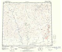 1951 Wiseman1952 Print · USGSThe Central Brooks Range in the early 1950s remained a frontier of isolated mining camps and river corridors. Researchers can trace the layout of Wiseman, Nolan, and Coldfoot, alongside remote landmarks like Pamichtuk Lake and the peaks of the Endicott Mountains.2 unique versions available
 - 1956 Map of Wiseman, 1959 Print
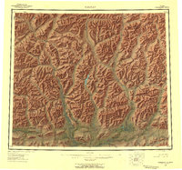 1956 Wiseman1959 Print · USGSThe central Brooks Range and the mining outposts of the Koyukuk valley are documented here in the mid-fifties. Researchers can locate remote cabins, placer mines, and historic landings like Wiseman, Coldfoot, and Tramway Bar along the Koyukuk River.10 unique versions available
 - 1964 Map of Wiseman
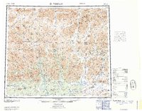 1964 Wiseman1964 Print · USGSThe Koyukuk River wilderness comes into focus in the mid-1950s, highlighting the isolated mining outposts of the Central Brooks Range. Researchers can trace the Tramway Bar Trail and locate historic Placer Mine sites near Wiseman, Nolan, and Coldfoot.
 - 1971 Map of Wiseman B-1, 1974 Print
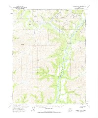 1971 Wiseman B-11974 Print · USGSThe northern interior near Wiseman is captured in the early seventies, a landscape still shaped by the gold rush and seasonal river travel. Researchers can trace the Winter Road and find remote sites like the Placer Mine at Nolan and the small Cem near the river.3 unique versions available
End of results
Showing maps 1-4 of 4
Frequently asked questions
- What are the different types of historical maps available for Coldfoot?
- What is the oldest map of Coldfoot?
- Where can I purchase historical maps of Coldfoot for my home or office?
- Where can I download high-res historical maps of Coldfoot?
- Are there historical topographic maps available for Coldfoot?
- Is there historical aerial imagery available for Coldfoot?
- Where are historical maps of Coldfoot sourced from?