1900s (20th Century) Maps of Evansville, Alaska
Explore 4 historic maps of Evansville from the 1900s (20th Century). These maps offer a rare glimpse into what life looked like during the 1900s — showing old roads, neighborhoods, homes, and landmarks that have changed or disappeared over time.
Whether you're researching your family's past, planning a metal detecting trip, or studying how Evansville's landscape evolved across the 1900s, these high-resolution maps are a powerful tool for exploring the history of this region.
- Focus on a specific era: All maps on this page are from the 1900s, giving you a focused view of this time period.
- See what’s changed: Compare century-old streets, trails, and buildings to today's modern landscape using overlays and satellite layers.
- Research with precision: Use these maps for genealogy, historical research, land use analysis, or educational projects.
- View, download, or print: Maps are fully viewable online in high resolution, and can be downloaded or printed for your own records.
Start exploring Evansville's history through authentic maps from the 1900s. This is your window into the past.
Evansville, AK maps
(4)- 1951 Map of Bettles, 1952 Print
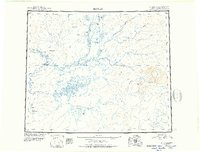 1951 Bettles1952 Print · USGSThe Koyukuk River valley appears in the early fifties as a landscape of isolated outposts and river-born travel. Trace the paths of the Winter Trail and the remote outposts at Bettles, Allakaket, and the Alatna Landing Area.
 - 1956 Map of Bettles, 1958 Print
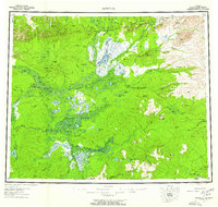 1956 Bettles1958 Print · USGSThe Alaskan interior during the mid-fifties reveals a landscape defined by winter trails and river navigation. Local historians can trace the foundations of Evansville, the neighboring communities of Allakaket and Alatna, and remote sites like Oscars Cabin.10 unique versions available
 - 1970 Map of Bettles D-4, 1973 Print
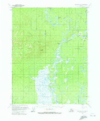 1970 Bettles D-41973 Print · USGSThe Koyukuk River backcountry comes into focus during the early seventies, centered on the aviation and river hub of Evansville. Researchers can trace the Winter Trail and locate remote sites like the Bettles Cem, Bettles Field, and Pitchuk Lake.2 unique versions available
 - 1970 Map of Bettles D-3, 1973 Print
 1970 Bettles D-31973 Print · USGSThe Alaskan interior during the early seventies is revealed here through its network of seasonal transport and river systems. Researchers can trace the Winter Road and Winter Trail through the Whye Jack Range and locate landmarks like Four Corners.
End of results
Showing maps 1-4 of 4
Top cities near Evansville
Frequently asked questions
- What are the different types of historical maps available for Evansville?
- What is the oldest map of Evansville?
- Where can I purchase historical maps of Evansville for my home or office?
- Where can I download high-res historical maps of Evansville?
- Are there historical topographic maps available for Evansville?
- Is there historical aerial imagery available for Evansville?
- Where are historical maps of Evansville sourced from?