Old Maps of Golovin, Alaska for Metal Detecting
Plan your next treasure hunt with 6 historic maps of Golovin. Find old homesites, ghost towns, trails, and gathering spots that may be lost to time — perfect for identifying promising metal detecting locations.
- Locate forgotten sites: Uncover places like long-lost settlements, abandoned rail lines, or gathering spots.
- Plan better hunts: Use map overlays combined with LiDAR or satellite views to narrow in on historically rich areas.
- Made for detectorists: Thousands of hobbyists use these maps to discover relics, coins, and hidden history.
Use these historic maps to boost your research and find new opportunities beneath the surface of Golovin.
Golovin, AK maps
(6)- 1950 Map of Solomon C-2, 1956 Print
 1950 Solomon C-21956 Print · USGSThe Seward Peninsula coast was still defined by its seasonal trails and maritime access during the early fifties. Local researchers can trace early communications via the Telephone Line or locate remote waypoints like the Shelter and Cabins near Golovnin Bay.2 unique versions available
 - 1950 Map of Solomon, 1956 Print
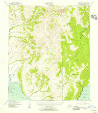
 1950 Solomon1956 Print · USGSThe southern Seward Peninsula is captured here in the mid-1950s, showing a landscape defined by coastal outposts and inland mining camps. Trace historic routes like the Winter Trail or locate the Big Hurrah Mine and Ruby Roadhouse.5 unique versions available
 - 1950 Map of Solomon C-3, 1956 Print
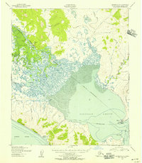 1950 Solomon C-31956 Print · USGSThe Seward Peninsula at the midpoint of the century shows a landscape of vital river and lagoon transportation. Researchers can trace the mid-century infrastructure of White Mountain, the village of Golovin, and remote outposts like Council Landing.3 unique versions available
 - 1951 Map of Solomon
 1951 Solomon1951 Print · USGSThe Seward Peninsula during the mid-century shows the intricate network of mining trails and coastal outposts that followed the gold rushes. Researchers can trace the Seward Peninsula Railroad and locate interior settlements like Council or the Big Hurrah Mine.3 unique versions available
 - 2014 Map of Solomon C-3 SE, 2014 Print
 2014 Solomon C-3 SE2014 Print · USGSThe coastal village of Golovin is captured here in the early twenty-first century, positioned between the lagoon and the sound. Researchers can trace the local street plan including Front Street and locate infrastructure like the Golovin Airport and South Spit.
 - 2014 Map of Solomon C-2 SW, 2014 Print
 2014 Solomon C-2 SW2014 Print · USGSCoastal Alaska's Seward Peninsula meets the sea at Golovnin Bay in this recent survey of the Solomon C-2 SW region. Trace the local hydrology through the courses of Cheenik Cr, McKinley Cr, and Portage Cr as they shape the terrain.
End of results
Showing maps 1-6 of 6
Frequently asked questions
- What are the different types of historical maps available for Golovin?
- What is the oldest map of Golovin?
- Where can I purchase historical maps of Golovin for my home or office?
- Where can I download high-res historical maps of Golovin?
- Are there historical topographic maps available for Golovin?
- Is there historical aerial imagery available for Golovin?
- Where are historical maps of Golovin sourced from?