Old Maps of Hooper Bay, Alaska for Metal Detecting
Plan your next treasure hunt with 9 historic maps of Hooper Bay. Find old homesites, ghost towns, trails, and gathering spots that may be lost to time — perfect for identifying promising metal detecting locations.
- Locate forgotten sites: Uncover places like long-lost settlements, abandoned rail lines, or gathering spots.
- Plan better hunts: Use map overlays combined with LiDAR or satellite views to narrow in on historically rich areas.
- Made for detectorists: Thousands of hobbyists use these maps to discover relics, coins, and hidden history.
Use these historic maps to boost your research and find new opportunities beneath the surface of Hooper Bay.
Hooper Bay, AK maps
(9)- 1951 Map of Hooper Bay
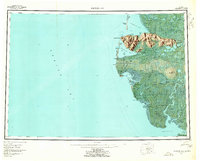
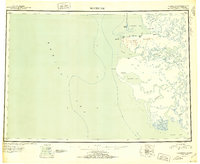 1951 Hooper Bay1951 Print · USGSThe Yukon-Kuskokwim Delta coast is captured here just after the war, showing the remote settlements and river systems of the Bering Sea. You can trace the Winter Trail between Scammon Bay and Kutmiut or locate the old landing at Hooper Bay.
 - 1952 Map of Hooper Bay C-4, 1959 Print
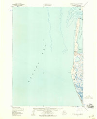 1952 Hooper Bay C-41959 Print · USGSThe remote Alaskan coast at the start of the 1950s reveals a wild interface of sea and sand. Trace the shifting shoreline of Panowat Spit and find unique coastal markers like the wreck and the winding Manayagvik Slough.2 unique versions available
 - 1952 Map of Hooper Bay B-3, 1959 Print
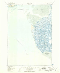 1952 Hooper Bay B-31959 Print · USGSCoastal Alaska in the early fifties was a land of shifting tides and intricate waterways along the Bering Sea. Researchers can trace the complex drainage of Painoroyun Slough and Issortulik Slough near the prominent Nuok Spit.3 unique versions available
 - 1952 Map of Hooper Bay C-3, 1959 Print
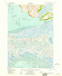 1952 Hooper Bay C-31959 Print · USGSCoastal Alaska in the early fifties is defined here by the intricate delta landscape of Igiak Bay and the village of Hooper Bay. Researchers can trace old coastal infrastructure and sites including the settlement at Paimiut, a cemetery, and the Nuok Spit coastline.3 unique versions available
 - 1953 Map of Hooper Bay, 1963 Print
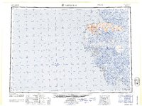
 1953 Hooper Bay1963 Print · USGSThe Bering Sea coast near the Yukon-Kuskokwim Delta appears here in the early fifties, showing a land of tidal rivers and tundra. Trace the locations of Hooper Bay, Chevak, and Old Chevak alongside the prominent As Kinuk Mountains.5 unique versions available
 - 1964 Map of Hooper Bay
 1964 Hooper Bay1964 Print · USGSCoastal Alaska's Yukon-Kuskokwim Delta is captured in the mid-sixties, a time when river travel and seasonal settlements defined the region. Genealogists and historians can trace the foundations of Hooper Bay and Chevak, or locate traditional sites like Paimiut and Old Chevak.
 - 2020 Map of Hooper Bay C-4 SE, 2020 Print
 2020 Hooper Bay C-4 SE2020 Print · USGSCoastal life in the Kusilvak Census Area is centered on the water during the early twenty-first century. Researchers can trace the layout of Hooper Bay and locate the vital Hooper Bay Airport situated near Manayagavik Slough.
 - 2020 Map of Hooper Bay B-3 NW, 2020 Print
 2020 Hooper Bay B-3 NW2020 Print · USGSThe coastal edge of the Bering Sea comes into focus in this recent study of the Kusilvak region in Alaska. Researchers can trace the shifting sands of Nuok Spit and the protected waters of Hooper Bay as they appeared in 2020.
 - 2020 Map of Hooper Bay C-3 SW, 2020 Print
 2020 Hooper Bay C-3 SW2020 Print · USGSThe coastal settlement of Hooper Bay is captured here during the early twenty-first century, showing its development alongside the surrounding tundra and wetlands. Researchers can trace local infrastructure like Airport Road and landmark locations such as the Hooper Bay Courthouse.
End of results
Showing maps 1-9 of 9
Frequently asked questions
- What are the different types of historical maps available for Hooper Bay?
- What is the oldest map of Hooper Bay?
- Where can I purchase historical maps of Hooper Bay for my home or office?
- Where can I download high-res historical maps of Hooper Bay?
- Are there historical topographic maps available for Hooper Bay?
- Is there historical aerial imagery available for Hooper Bay?
- Where are historical maps of Hooper Bay sourced from?