Old Maps of Jack Wade, Alaska for Academic Research
Study the evolution of Jack Wade with 6 high-resolution historic maps. Whether you're teaching, researching, or modeling changes in land use, these maps provide essential visual documentation of urban, environmental, and geographic change.
- Analyze long-term change: Track patterns in development, transportation, and natural features.
- Ideal for environmental or urban studies: Support academic projects with primary historical map data.
- Use in the classroom or lab: Educators and researchers rely on these maps to bring historical context to life.
These maps are a powerful tool for teaching, research, and visualizing how Jack Wade has changed over the decades.
Jack Wade, AK maps
(6)- 1899 Map of Fortymile, 1902 Print
 1899 Fortymile1902 Print · USGSThe Alaska-Yukon borderlands come into focus at the end of the nineteenth century during the height of the northern gold rushes. Local historians can trace early mining outposts and frontier hubs like Eagle City, Star City, and Seventymile along the Yukon River.3 unique versions available
 - 1951 Map of Eagle
 1951 Eagle1951 Print · USGSThe eastern Alaska wilderness at the Yukon border is captured here in the early fifties, a time when gold mining camps and bush outposts defined the interior. Trace the paths of prospectors through Chicken, Jack Wade, and the abandoned camp at Seventymile.4 unique versions available
 - 1956 Map of Eagle A-1, 1963 Print
 1956 Eagle A-11963 Print · USGSThe Fortymile mining district in the mid-1950s reveals a landscape of remote resource extraction along the Canada border. Trace the remnants of the gold rush era via Dredge Tailings, the settlement of Jack Wade, and high-altitude landmarks like Davis Dome.4 unique versions available
 - 1957 Map of Eagle, 1966 Print
 1957 Eagle1966 Print · USGSThe eastern Alaska interior comes into focus during the mid-fifties, showing the remote river outposts and mining camps along the Canadian border. Genealogists and historians can trace the early Taylor Highway corridor to Chicken, Jack Wade, and Eagle Village.6 unique versions available
 - 2018 Map of Eagle A-1 NW, 2018 Print
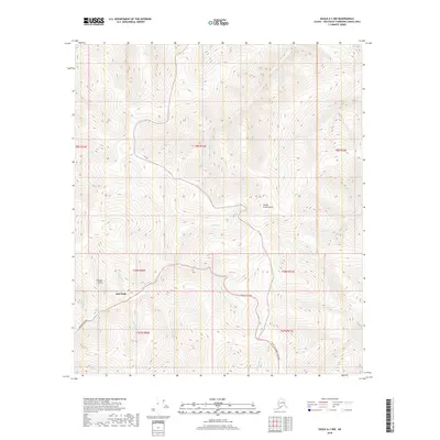 2018 Eagle A-1 NW2018 Print · USGSThe interior Alaska wilderness near the Canadian border is captured here during the late 2010s, centered on the historic mining locality of Jack Wade. Researchers can trace the rugged drainage of Wade Cr and Fifteen Gulch where the Taylor Highway meets the ridges.
 - 2023 Map of Eagle A-1 NW, 2023 Print
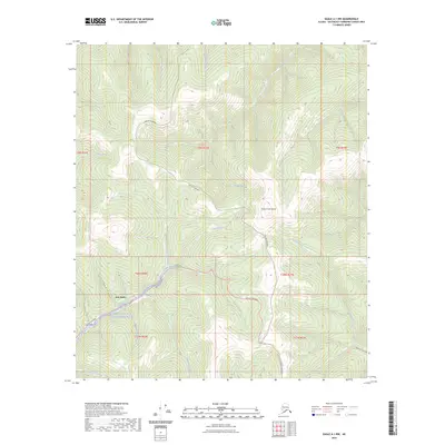 2023 Eagle A-1 NW2023 Print · USGSThe interior Alaskan wilderness near the Yukon border is mapped here in the modern era. Researchers can trace the winding Taylor Highway past the settlement of Jack Wade and the protected Fortymile Wild and Scenic River.
End of results
Showing maps 1-6 of 6
Frequently asked questions
- What are the different types of historical maps available for Jack Wade?
- What is the oldest map of Jack Wade?
- Where can I purchase historical maps of Jack Wade for my home or office?
- Where can I download high-res historical maps of Jack Wade?
- Are there historical topographic maps available for Jack Wade?
- Is there historical aerial imagery available for Jack Wade?
- Where are historical maps of Jack Wade sourced from?