Old Maps of Kechumstuk, Alaska for Hiking & Exploration
Hike through history with 4 historic maps of Kechumstuk. Explore old trails, ghost towns, and forgotten backroads — perfect for outdoor adventurers and local explorers.
- Rediscover forgotten places: Map out old mining camps, roads, and footpaths that no longer exist on modern maps.
- Layer with modern tools: Combine with LiDAR or satellite views to plan hikes through historical terrain.
- Made for exploration: Popular among hikers, overlanders, and local history lovers.
Use these maps to find adventure and explore the hidden past of Kechumstuk.
Kechumstuk, AK maps
(4)- 1951 Map of Eagle
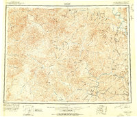 1951 Eagle1951 Print · USGSThe eastern Alaska wilderness at the Yukon border is captured here in the early fifties, a time when gold mining camps and bush outposts defined the interior. Trace the paths of prospectors through Chicken, Jack Wade, and the abandoned camp at Seventymile.4 unique versions available
 - 1956 Map of Eagle A-4, 1964 Print
 1956 Eagle A-41964 Print · USGSThe Alaska interior around Kechumstuk is captured here during the mid-1950s before modern development. Genealogists and historians can trace seasonal movement via the Winter Trail and locate early structures like the Cabin (Ruins).
 - 1957 Map of Eagle, 1966 Print
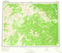 1957 Eagle1966 Print · USGSThe eastern Alaska interior comes into focus during the mid-fifties, showing the remote river outposts and mining camps along the Canadian border. Genealogists and historians can trace the early Taylor Highway corridor to Chicken, Jack Wade, and Eagle Village.6 unique versions available
 - 2018 Map of Eagle A-4 SE, 2018 Print
 2018 Eagle A-4 SE2018 Print · USGSIn the interior wilderness of the Southeast Fairbanks Census Area, this 2018 survey captures a remote subarctic landscape before any modern development. Hydrologists and researchers can trace the intricate headwaters of Kechumstuk Cr and the Mosquito Fork.
End of results
Showing maps 1-4 of 4
Frequently asked questions
- What are the different types of historical maps available for Kechumstuk?
- What is the oldest map of Kechumstuk?
- Where can I purchase historical maps of Kechumstuk for my home or office?
- Where can I download high-res historical maps of Kechumstuk?
- Are there historical topographic maps available for Kechumstuk?
- Is there historical aerial imagery available for Kechumstuk?
- Where are historical maps of Kechumstuk sourced from?