
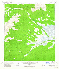
1956 Map of Eagle A-4
USGS Topo · Published 1964About this map
Kechumstuk and the surrounding interior wilderness of Alaska appear here as they were documented in the mid-1950s. The landscape is defined by high elevations, including Mt Veta VABM 5825 and Kechumstuk Mountain VABM 5002, which overlook a complex network of drainages such as Mosquito Fork and Telegraph Creek. Evidence of early habitation and movement through this difficult terrain is found at the Cabin (Ruins) and along established paths like the Winter Trail and Tractor Trail. These routes reflect the historical necessity of seasonal travel in the subarctic, connecting remote outposts where roads did not yet exist. The mapping of Kechumstuk Creek and other smaller tributaries like Veta Creek and Cedar Creek provides a detailed record of the hydrography before significant modern changes in the region.
Find a feature on this map
15 named features on this map. Tap any name to fly to it.
Don’t see what you’re looking for? This feature index may not catch every label — zoom into the map to look around manually.
Map Details
Editions of this 1956 Eagle A-4 Map
This is the sole edition of this map. No revisions or reprints were ever made.
Other maps of this area

1949 · Tanacross
USGS Topo · 1:250,000

1950 · Tanacross
USGS Topo · 1:250,000

1951 · Eagle
USGS Topo · 1:250,000

1956 · Tanacross D-3
USGS Topo · 1:63,360

1956 · Eagle B-3
USGS Topo · 1:63,360

1956 · Tanacross D-4
USGS Topo · 1:63,360

1956 · Eagle A-5
USGS Topo · 1:63,360

1956 · Eagle B-5
USGS Topo · 1:63,360

1956 · Eagle B-4
USGS Topo · 1:63,360
1956 · Tanacross D-5
USGS Topo · 1:63,360