
1956 Map of Eagle B-4
USGS Topo · Published 1964About this map
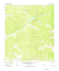
The Fortymile River serves as the central drainage for this remote interior landscape, where the confluence of the North Fork and Middle Fork dictates the topography. This 1956 survey, compiled from mid-century aerial photography, documents a region defined by its hydrography and mining-era nomenclature. The presence of a Cabin (Ruins) near Fish Creek suggests the ephemeral nature of human habitation in this subarctic wilderness, while the names of numerous tributaries such as Gold Bottom Creek, Silver Blue Creek, and McKinley Creek point to the area's legacy of prospecting. Further east, smaller drainages like Manila Creek and Chicago Creek feed into the larger river systems, illustrating a complex network of waterways that have historically provided the only reliable corridors through the dense terrain of the Yukon-Tanana Uplands.
Find a feature on this map
25 named features on this map. Tap any name to fly to it.
Don’t see what you’re looking for? This feature index may not catch every label — zoom into the map to look around manually.
Map Details
Editions of this 1956 Eagle B-4 Map
2 editions found
Other maps of this area

1951 · Eagle
USGS Topo · 1:250,000

1956 · Eagle B-3
USGS Topo · 1:63,360

1956 · Eagle A-5
USGS Topo · 1:63,360

1956 · Eagle B-5
USGS Topo · 1:63,360

1956 · Eagle C-3
USGS Topo · 1:63,360

1956 · Eagle A-4
USGS Topo · 1:63,360

1956 · Eagle C-5
USGS Topo · 1:63,360
1956 · Eagle C-4
USGS Topo · 1:63,360
1957 · Eagle A-3
USGS Topo · 1:63,360

1957 · Eagle
USGS Topo · 1:250,000