
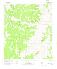
1956 Map of Eagle A-5
USGS Topo · Published 1964About this map
The North Fork Fortymile River and its Middle Fork converge in the northwestern portion of this 1950s survey, defining a drainage network that has historically drawn gold seekers to this part of Alaska. The landscape is dominated by the high elevation of Mt Veta and a series of named watercourses including Norvell Creek, My Creek, and Silas Pup. Evidence of remote navigation is limited to a single Tractor Trail that winds through the eastern valley of Caribou Creek.
Find a feature on this map
17 named features on this map. Tap any name to fly to it.
Don’t see what you’re looking for? This feature index may not catch every label — zoom into the map to look around manually.
Map Details
Editions of this 1956 Eagle A-5 Map
2 editions found
Other maps of this area

1949 · Tanacross
USGS Topo · 1:250,000

1950 · Tanacross
USGS Topo · 1:250,000

1951 · Eagle
USGS Topo · 1:250,000

1954 · Tanacross D-6
USGS Topo · 1:63,360
1955 · Tanacross D-6
USGS Topo · 1:63,360

1956 · Tanacross D-4
USGS Topo · 1:63,360

1956 · Eagle B-5
USGS Topo · 1:63,360

1956 · Eagle B-4
USGS Topo · 1:63,360

1956 · Eagle A-4
USGS Topo · 1:63,360
1956 · Tanacross D-5
USGS Topo · 1:63,360