
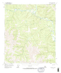
1956 Map of Eagle B-3
USGS Topo · Published 1963About this map
The Middle Fork Fortymile River and its confluence with the North Fork anchor this mid-century survey of the Alaska interior. The landscape is defined by the sinuous path of the river, which makes a sharp loop at The Kink to the east. Evidence of the region's mining heritage is present along Montana Creek, where a remote Mine and several Cabins are situated. The presence of a Landing Strip near the headwaters of Hutchinson Creek indicates the logistical challenges of this terrain, where aviation became essential for reaching isolated outposts. The designation of Fortymile (Site) near the river junction points to an earlier era of habitation along the water. This 1950s record captures a moment when resource extraction and seasonal settlements like those along Bullion Creek and Confederate Creek were the primary drivers of human activity in the territory.
Find a feature on this map
13 named features on this map. Tap any name to fly to it.
Don’t see what you’re looking for? This feature index may not catch every label — zoom into the map to look around manually.
Map Details
Editions of this 1956 Eagle B-3 Map
2 editions found
Other maps of this area

1899 · Fortymile
USGS Topo · 1:250,000

1951 · Eagle
USGS Topo · 1:250,000

1956 · Eagle C-2
USGS Topo · 1:63,360

1956 · Eagle B-2
USGS Topo · 1:63,360

1956 · Eagle A-2
USGS Topo · 1:63,360

1956 · Eagle B-4
USGS Topo · 1:63,360

1956 · Eagle C-3
USGS Topo · 1:63,360

1956 · Eagle A-4
USGS Topo · 1:63,360
1956 · Eagle C-4
USGS Topo · 1:63,360
1957 · Eagle A-3
USGS Topo · 1:63,360