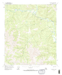
1956 Map of Eagle B-3
USGS Topo · Published 1963About this map
Middle Fork Fortymile River and the North Fork Fortymile River converge in this mid-century survey of the Alaskan interior. The landscape is defined by its gold mining history, evidenced by the presence of a Mine and numerous cabins along the drainage basins of Bullion Creek and Hutchinson Creek. The area includes the historic Fortymile (Site), once a pivotal hub during the regional gold rushes.
Find a feature on this map
13 named features on this map. Tap any name to fly to it.
Don’t see what you’re looking for? This feature index may not catch every label — zoom into the map to look around manually.
Map Details
Editions of this 1956 Eagle B-3 Map
2 editions found
Other maps of this area

1899 · Fortymile
USGS Topo · 1:250,000

1951 · Eagle
USGS Topo · 1:250,000

1956 · Eagle C-2
USGS Topo · 1:63,360

1956 · Eagle B-2
USGS Topo · 1:63,360

1956 · Eagle A-2
USGS Topo · 1:63,360

1956 · Eagle B-3
USGS Topo · 1:63,360

1956 · Eagle B-4
USGS Topo · 1:63,360

1956 · Eagle C-3
USGS Topo · 1:63,360

1956 · Eagle A-4
USGS Topo · 1:63,360
1956 · Eagle C-4
USGS Topo · 1:63,360