
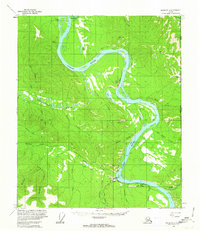
1956 Map of Eagle C-2
USGS Topo · Published 1963About this map
Glacier Mountain dominates the northwestern portion of this 1950s interior landscape, serving as the high point for a complex network of waterways that define the region's geography. The map reveals a remote territory largely devoid of modern infrastructure, where human presence is marked only by a lone Cabin and mysterious Ruins situated near the headwaters of the surrounding drainages. These features suggest an era of prospecting or early mountain travel long before permanent development reached this part of the Yukon-Tanana Uplands. Drainage patterns are meticulously detailed, showing how Mission Creek and its many tributaries, including Black Diamond Creek and Dominion Creek, carve through the terrain. The presence of VABM 5593 Oregon indicates the precise geodetic control used by the Geological Survey during this mid-century aerial photogrammetric study.
Find a feature on this map
16 named features on this map. Tap any name to fly to it.
Don’t see what you’re looking for? This feature index may not catch every label — zoom into the map to look around manually.
Map Details
Editions of this 1956 Eagle C-2 Map
This is the sole edition of this map. No revisions or reprints were ever made.
Other maps of this area

1899 · Fortymile
USGS Topo · 1:250,000

1951 · Eagle
USGS Topo · 1:250,000

1956 · Eagle C-1
USGS Topo · 1:63,360

1956 · Eagle D-2
USGS Topo · 1:63,360

1956 · Eagle B-2
USGS Topo · 1:63,360

1956 · Eagle D-3
USGS Topo · 1:63,360
1956 · Eagle D-1
USGS Topo · 1:63,360

1956 · Eagle B-1
USGS Topo · 1:63,360

1956 · Eagle B-3
USGS Topo · 1:63,360

1956 · Eagle C-3
USGS Topo · 1:63,360