
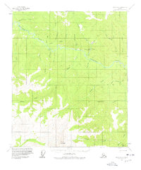
1956 Map of Eagle D-2
USGS Topo · Published 1963About this map
The Seventymile River carves a winding path through this portion of the Yukon-Koyukuk region, anchoring a landscape defined by seasonal transportation and small-scale resource extraction in the mid-1950s. The presence of a Winter Trail and a Tractor Trail highlights the importance of overland routes for supply and access before modern road networks. Evidence of human activity is concentrated along the waterways, where isolated Cabins and a Landing Strip near Crooked Creek served prospectors or trappers. A Flume located on Eldorado Creek suggests historical mining operations, while the southern terrain is dominated by the elevations of Mount Eldridge. The map also records localized navigation hazards and landmarks such as The Falls and the gravel deposit at Curtis Bar, providing a snapshot of the interior's topography before more intensive modern development altered these remote drainages.
Find a feature on this map
35 named features on this map. Tap any name to fly to it.
Don’t see what you’re looking for? This feature index may not catch every label — zoom into the map to look around manually.
Map Details
Editions of this 1956 Eagle D-2 Map
2 editions found
Other maps of this area

1899 · Fortymile
USGS Topo · 1:250,000

1951 · Charley River
USGS Topo · 1:250,000

1951 · Eagle
USGS Topo · 1:250,000

1956 · Charley River A-3
USGS Topo · 1:63,360

1956 · Charley River A-2
USGS Topo · 1:63,360

1956 · Charley River A-1
USGS Topo · 1:63,360

1956 · Charley River
USGS Topo · 1:250,000

1956 · Eagle C-1
USGS Topo · 1:63,360

1956 · Eagle C-2
USGS Topo · 1:63,360

1956 · Eagle D-3
USGS Topo · 1:63,360