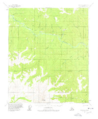
1956 Map of Eagle D-2
USGS Topo · Published 1978About this map
The Seventymile River winds through this remote interior Alaskan landscape, serving as the primary geographic corridor for mid-century activity. This 1956 survey documents the small settlement at Crooked Creek and the river obstacle known as The Falls, marking an era where transport relied heavily on seasonal routes like the Winter Trail and a Tractor Trail near Aurora Creek. A Landing Strip near the confluence of Crooked Creek and the river indicates the increasing importance of bush aviation for reaching isolated camps and mining claims.
Find a feature on this map
34 named features on this map. Tap any name to fly to it.
Don’t see what you’re looking for? This feature index may not catch every label — zoom into the map to look around manually.
Map Details
Editions of this 1956 Eagle D-2 Map
2 editions found
Other maps of this area

1899 · Fortymile
USGS Topo · 1:250,000

1951 · Charley River
USGS Topo · 1:250,000

1951 · Eagle
USGS Topo · 1:250,000

1956 · Charley River A-3
USGS Topo · 1:63,360

1956 · Charley River A-2
USGS Topo · 1:63,360

1956 · Charley River A-1
USGS Topo · 1:63,360

1956 · Charley River
USGS Topo · 1:250,000

1956 · Eagle C-1
USGS Topo · 1:63,360

1956 · Eagle D-2
USGS Topo · 1:63,360

1956 · Eagle C-2
USGS Topo · 1:63,360