
1956 Map of Charley River A-3
USGS Topo · Published 1960About this map
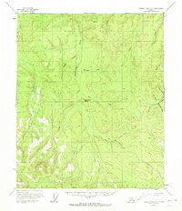
Washington Creek and its many tributaries carve through this interior Alaskan landscape, captured during a 1950s survey of the Charley River region. The map reveals the early industrial footprint of the territory through the presence of a Placer Mine located near Seventeen Gulch and Fourth of July Creek. A prominent Ditch system and a designated Tractor Trail cutting across the southern sections suggest active resource extraction and the specialized transportation methods required in such an unroaded environment. Significant high points like VABM 2452 Glenn and VABM 2908 Dome anchor the terrain, while several Pingo formations are specifically noted, highlighting the permafrost characteristics of the soil. This survey provides a record of the remote drainages and small-scale mining operations that defined the region before later developments changed the wilderness character of the Eagle Creek watershed.
Find a feature on this map
21 named features on this map. Tap any name to fly to it.
Don’t see what you’re looking for? This feature index may not catch every label — zoom into the map to look around manually.
Map Details
Editions of this 1956 Charley River A-3 Map
2 editions found
Other maps of this area

1899 · Fortymile
USGS Topo · 1:250,000

1951 · Charley River
USGS Topo · 1:250,000

1951 · Eagle
USGS Topo · 1:250,000

1956 · Charley River A-4
USGS Topo · 1:63,360

1956 · Charley River B-3
USGS Topo · 1:63,360

1956 · Charley River B-2
USGS Topo · 1:63,360

1956 · Charley River A-2
USGS Topo · 1:63,360

1956 · Charley River B-4
USGS Topo · 1:63,360

1956 · Charley River
USGS Topo · 1:250,000

1956 · Eagle D-2
USGS Topo · 1:63,360