
1956 Map of Charley River B-4
USGS Topo · Published 1960About this map
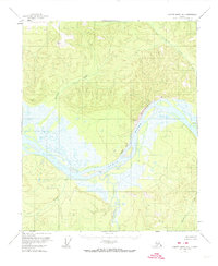
The Yukon River carves a massive, winding path through the center of this 1950s interior Alaska landscape, defining the region's geography and historical travel routes. Along its banks, the dramatic rise of Chester Bluff stands over the northern shore, while a solitary Cabin sits near the confluence of Woodchopper Creek, hinting at the sparse human footprint in this wilderness during the mid-century era. The terrain is characterized by extensive wetlands and complex hydrological features, including the presence of a Pingo, a characteristic permafrost mound.
Find a feature on this map
15 named features on this map. Tap any name to fly to it.
Don’t see what you’re looking for? This feature index may not catch every label — zoom into the map to look around manually.
Map Details
Editions of this 1956 Charley River B-4 Map
Other maps of this area

1951 · Charley River
USGS Topo · 1:250,000

1956 · Charley River C-5
USGS Topo · 1:63,360

1956 · Charley River A-5
USGS Topo · 1:63,360

1956 · Charley River A-4
USGS Topo · 1:63,360

1956 · Charley River B-5
USGS Topo · 1:63,360

1956 · Charley River B-3
USGS Topo · 1:63,360

1956 · Charley River C-4
USGS Topo · 1:63,360

1956 · Charley River A-3
USGS Topo · 1:63,360
1956 · Charley River C-3
USGS Topo · 1:63,360

1956 · Charley River
USGS Topo · 1:250,000