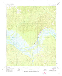
1956 Map of Charley River B-4
USGS Topo · Published 1974About this map
The confluence of the Charley River and the mighty Yukon River dominates this mid-century interior landscape, showing the river systems as they appeared before extensive modern changes. Several isolated outposts, marked simply as Cabin, dot the riverbanks, suggesting the seasonal trapping or fishing lifestyle of the era. The terrain is defined by dramatic riverfront features such as Biederman Bluff and Chester Bluff, which overlook a complex network of braids and islands within the main channel. Inland, the map follows the drainage of numerous named waterways including Andrew Creek, Threemile Creek, and Washrinarin Creek, providing a detailed look at the hydrology of the Yukon-Koyukuk region. Several Vertical Angle Bench Marks, such as VABM 1663 Trail and VABM 1961 Wood, indicate the precise points used for this 1950s topographic study.
Find a feature on this map
17 named features on this map. Tap any name to fly to it.
Don’t see what you’re looking for? This feature index may not catch every label — zoom into the map to look around manually.
Map Details
Editions of this 1956 Charley River B-4 Map
Other maps of this area

1951 · Charley River
USGS Topo · 1:250,000

1956 · Charley River C-5
USGS Topo · 1:63,360

1956 · Charley River A-5
USGS Topo · 1:63,360

1956 · Charley River A-4
USGS Topo · 1:63,360

1956 · Charley River B-5
USGS Topo · 1:63,360

1956 · Charley River B-3
USGS Topo · 1:63,360

1956 · Charley River C-4
USGS Topo · 1:63,360

1956 · Charley River A-3
USGS Topo · 1:63,360
1956 · Charley River C-3
USGS Topo · 1:63,360

1956 · Charley River B-4
USGS Topo · 1:63,360