
1956 Map of Charley River C-4
USGS Topo · Published 1960About this map
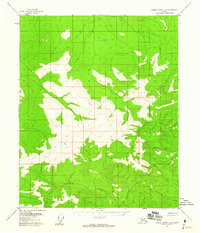
High-altitude interior Alaskan terrain dominates this 1950s survey, centered on the prominent triangulation station at VABM Tim 4273. The landscape is defined by a series of significant drainage systems that carve through the upland elevations, most notably the winding paths of Threemile Creek, Judge Creek, and Mardow Creek. A notable geological feature, identified simply as a Pingo, appears in the eastern portion of the quadrangle, indicating the presence of permafrost-driven landforms characteristic of this subarctic region. Far to the southeast, Sevenmile Creek cuts across the lower corner of the sheet. Produced before extensive modern development, the map shows a wilderness area devoid of established roads or trails, where land lines represent unsurveyed locations predetermined by the Bureau of Land Management.
Find a feature on this map
6 named features on this map. Tap any name to fly to it.
Don’t see what you’re looking for? This feature index may not catch every label — zoom into the map to look around manually.
Map Details
Editions of this 1956 Charley River C-4 Map
2 editions found
Other maps of this area

1951 · Charley River
USGS Topo · 1:250,000
1956 · Charley River D-4
USGS Topo · 1:63,360
1956 · Charley River D-5
USGS Topo · 1:63,360

1956 · Charley River C-5
USGS Topo · 1:63,360

1956 · Charley River D-3
USGS Topo · 1:63,360

1956 · Charley River B-5
USGS Topo · 1:63,360

1956 · Charley River B-3
USGS Topo · 1:63,360
1956 · Charley River C-3
USGS Topo · 1:63,360

1956 · Charley River B-4
USGS Topo · 1:63,360

1956 · Charley River
USGS Topo · 1:250,000