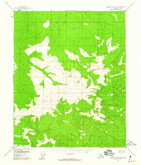
1956 Map of Charley River C-4
USGS Topo · Published 1960About this map
High peaks and glacial landforms dominate this interior Alaskan wilderness, as documented by the U.S. Geological Survey using aerial photography from the early 1950s. The landscape is anchored by the prominent VABM Tim 4273, which stands as a primary surveying benchmark amidst complex ridgelines and alpine tundra. This area lacks any roads or human settlements, reflecting the pure topographic character of the region before modern development or resource exploration.
Find a feature on this map
6 named features on this map. Tap any name to fly to it.
Don’t see what you’re looking for? This feature index may not catch every label — zoom into the map to look around manually.
Map Details
Editions of this 1956 Charley River C-4 Map
2 editions found
Other maps of this area

1951 · Charley River
USGS Topo · 1:250,000
1956 · Charley River D-4
USGS Topo · 1:63,360
1956 · Charley River D-5
USGS Topo · 1:63,360

1956 · Charley River C-5
USGS Topo · 1:63,360

1956 · Charley River D-3
USGS Topo · 1:63,360

1956 · Charley River B-5
USGS Topo · 1:63,360

1956 · Charley River B-3
USGS Topo · 1:63,360

1956 · Charley River C-4
USGS Topo · 1:63,360
1956 · Charley River C-3
USGS Topo · 1:63,360

1956 · Charley River B-4
USGS Topo · 1:63,360