
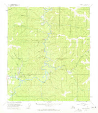
1956 Map of Eagle A-2
USGS Topo · Published 1963About this map
Chicken and Franklin serve as the primary human outposts in this 1950s study of the Fortymile mining district. The landscape is defined by the winding course of the North Fork Fortymile River and its numerous tributaries, where evidence of resource extraction is visible through Dredge Tailings and scattered Placer Mine operations. The construction of the Taylor Highway provides a critical lifeline through the territory, linking isolated settlements and airfields like the Franklin Landing Strip and Lassen Landing Strip to the broader region.
Find a feature on this map
38 named features on this map. Tap any name to fly to it.
Don’t see what you’re looking for? This feature index may not catch every label — zoom into the map to look around manually.
Map Details
Editions of this 1956 Eagle A-2 Map
2 editions found
Other maps of this area

1899 · Fortymile
USGS Topo · 1:250,000

1949 · Tanacross
USGS Topo · 1:250,000

1950 · Tanacross
USGS Topo · 1:250,000

1951 · Eagle
USGS Topo · 1:250,000

1956 · Tanacross D-3
USGS Topo · 1:63,360

1956 · Tanacross D-2
USGS Topo · 1:63,360

1956 · Tanacross D-1
USGS Topo · 1:63,360

1956 · Eagle A-1
USGS Topo · 1:63,360

1956 · Eagle B-2
USGS Topo · 1:63,360

1956 · Eagle B-1
USGS Topo · 1:63,360