
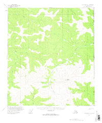
1956 Map of Tanacross D-1
USGS Topo · Published 1962About this map
The Alaska and Yukon border defines the eastern edge of this mid-century interior landscape, where the Sixtymile River meanders through high-elevation terrain. This survey captures a remote wilderness primarily shaped by drainage systems like Liberty Creek and the North Fork Ladue River. A single Cabin and a designated Winter Trail represent the sparse human footprint in this period, suggesting a landscape used for seasonal travel or trapping rather than permanent settlement.
Find a feature on this map
20 named features on this map. Tap any name to fly to it.
Don’t see what you’re looking for? This feature index may not catch every label — zoom into the map to look around manually.
Map Details
Editions of this 1956 Tanacross D-1 Map
2 editions found
Other maps of this area

1899 · Fortymile
USGS Topo · 1:250,000

1949 · Tanacross
USGS Topo · 1:250,000

1950 · Tanacross
USGS Topo · 1:250,000

1951 · Eagle
USGS Topo · 1:250,000

1956 · Tanacross C-1
USGS Topo · 1:63,360

1956 · Tanacross D-2
USGS Topo · 1:63,360

1956 · Tanacross C-2
USGS Topo · 1:63,360

1956 · Eagle A-1
USGS Topo · 1:63,360

1956 · Eagle A-2
USGS Topo · 1:63,360

1956 · Tanacross
USGS Topo · 1:250,000