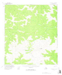
1956 Map of Tanacross D-1
USGS Topo · Published 1962About this map
The United States Canada international boundary marks the eastern edge of this landscape, where the Alaska Yukon border follows a straight north-south line through the high country. The terrain is defined by a dense network of waterways, including the winding Sixtymile River and the North Ladue River, which carve through the subarctic topography. A remote Cabin sits near the East Fork Dennison Fork, suggesting the isolated human presence in this region during the mid-1950s. High peaks like Divide Mtn and Witherspoon serve as surveying benchmarks across the ridges. Movement through this wilderness is traced by a Winter Trail that navigates the valleys, while distinctive geological features like Fishhook Bend and various creeks such as Liberty Creek and Dude Creek illustrate the complex drainage patterns of the upper Tanacross area.
Find a feature on this map
21 named features on this map. Tap any name to fly to it.
Don’t see what you’re looking for? This feature index may not catch every label — zoom into the map to look around manually.
Map Details
Editions of this 1956 Tanacross D-1 Map
2 editions found
Other maps of this area

1899 · Fortymile
USGS Topo · 1:250,000

1949 · Tanacross
USGS Topo · 1:250,000

1950 · Tanacross
USGS Topo · 1:250,000

1951 · Eagle
USGS Topo · 1:250,000

1956 · Tanacross C-1
USGS Topo · 1:63,360

1956 · Tanacross D-2
USGS Topo · 1:63,360

1956 · Tanacross C-2
USGS Topo · 1:63,360

1956 · Tanacross D-1
USGS Topo · 1:63,360

1956 · Eagle A-1
USGS Topo · 1:63,360

1956 · Eagle A-2
USGS Topo · 1:63,360