Old Maps of Lower Kalskag, Alaska for Academic Research
Study the evolution of Lower Kalskag with 5 high-resolution historic maps. Whether you're teaching, researching, or modeling changes in land use, these maps provide essential visual documentation of urban, environmental, and geographic change.
- Analyze long-term change: Track patterns in development, transportation, and natural features.
- Ideal for environmental or urban studies: Support academic projects with primary historical map data.
- Use in the classroom or lab: Educators and researchers rely on these maps to bring historical context to life.
These maps are a powerful tool for teaching, research, and visualizing how Lower Kalskag has changed over the decades.
Lower Kalskag, AK maps
(5)- 1947 Map of Russian Mission, 1957 Print
 1947 Russian Mission1957 Print · USGSSouthwest Alaska in the late 1940s is mapped here as a vast network of river settlements and mountain outposts. Researchers can trace historic river life and early aviation at Russian Mission, Kako Air Field, and Crow Village.2 unique versions available
 - 1950 Map of Russian Mission
 1950 Russian Mission1950 Print · USGSThe Yukon-Kuskokwim Delta region comes alive in the early post-war era, showing the river-bound lifeways of the Alaskan interior. Local historians and genealogists can trace remote outposts like Russian Mission, Dogfish Village, and Nyac, or locate family sites like Phillips Broe.
 - 1954 Map of Russian Mission C-4, 1962 Print
 1954 Russian Mission C-41962 Print · USGSThe Kuskokwim River valley in the mid-1950s shows a landscape of river-oriented settlements and vast tundra lakes. Trace the early footprints of Kalskag and Lower Kalskag, find local landmarks like the Cem, and follow the route of the Winter Trail.2 unique versions available
 - 1980 Map of Russian Mission
 1980 Russian Mission1980 Print · USGSThe Yukon and Kuskokwim river basins are detailed here during the late twentieth century, showing a network of remote villages and seasonal camps. Researchers can trace traditional travel routes and settlements like Russian Mission, Chuathbaluk, and the historic Portage Trail.3 unique versions available
 - 2017 Map of Russian Mission C-4 SW, 2017 Print
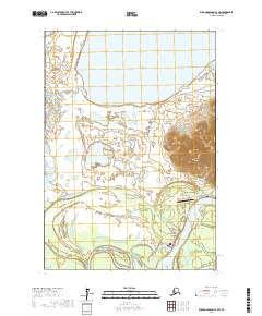 2017 Russian Mission C-4 SW2017 Print · USGSThe Kuskokwim River corridor comes into focus in this recent study of western Alaska. Genealogists and researchers can trace the roads and landmarks connecting Upper Kalskag and Lower Kalskag, including the Kalskag Airport and Arhymot Lake.
End of results
Showing maps 1-5 of 5
Top cities near Lower Kalskag
Frequently asked questions
- What are the different types of historical maps available for Lower Kalskag?
- What is the oldest map of Lower Kalskag?
- Where can I purchase historical maps of Lower Kalskag for my home or office?
- Where can I download high-res historical maps of Lower Kalskag?
- Are there historical topographic maps available for Lower Kalskag?
- Is there historical aerial imagery available for Lower Kalskag?
- Where are historical maps of Lower Kalskag sourced from?