Old Maps of Nunapitchuk, Alaska for Genealogy
Trace your family roots with 5 historic maps of Nunapitchuk. These high-res maps reveal old neighborhoods, homesites, landmarks, and streets — helping you uncover where your ancestors lived and how the area evolved over time.
- Explore historic neighborhoods: Identify where your relatives may have lived in the 1800s or 1900s.
- Compare maps over time: Trace the changes in streets, buildings, and landmarks for multi-generational research.
- Perfect for genealogy & ancestry research: Used by family historians and researchers to map out lineage and migration.
These maps are an incredible resource for exploring your personal connection to Nunapitchuk's past.
Nunapitchuk, AK maps
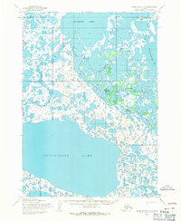
(5)- 1951 Map of Baird Inlet, 1953 Print
 1951 Baird Inlet1953 Print · USGSThe Yukon-Kuskokwim Delta's vast water-webbed landscape is shown here in the early fifties during a period of transition. Genealogists and researchers can trace the locations of traditional sites like Nunapitchuk alongside several sites marked as abandoned, such as Akulurak and Kinak.
 - 1954 Map of Baird Inlet, 1967 Print
 1954 Baird Inlet1967 Print · USGSThe Yukon-Kuskokwim Delta comes into focus in the mid-1950s, showing a vast network of tundra lakes and coastal estuaries. Researchers can locate active villages like Chefornak and Kasigluk or trace historical settlement sites such as Chakchak and Monrak.3 unique versions available
 - 1954 Map of Baird Inlet D-2, 1971 Print
 1954 Baird Inlet D-21971 Print · USGSThe Yukon-Kuskokwim Delta tundra is documented here in the mid-1950s, showing a transition between seasonal sites and established river settlements. Trace local history at Kasigluk, the Kvigatluk (Site), and the frozen routes of the Winter Trail.2 unique versions available
 - 2017 Map of Baird Inlet D-2 SE, 2017 Print
 2017 Baird Inlet D-2 SE2017 Print · USGSThe northern tundra near Bethel comes into focus during the late 2010s, showing a land defined by water and remote settlement. Researchers can trace the reach of the Johnson River and locate the community at Kasigluk alongside the vital Kasigluk Airport.
 - 2017 Map of Baird Inlet D-2 NE, 2017 Print
 2017 Baird Inlet D-2 NE2017 Print · USGSThe village of Nunapitchuk and its surrounding tundra waterways are documented in this 2017 study of the Yukon-Kuskokwim Delta. Researchers can trace the Old Kasigluk-Main Road and locate the Nunapitchuk Airport near the banks of the Johnson River.
End of results
Showing maps 1-5 of 5
Top cities near Nunapitchuk
Frequently asked questions
- What are the different types of historical maps available for Nunapitchuk?
- What is the oldest map of Nunapitchuk?
- Where can I purchase historical maps of Nunapitchuk for my home or office?
- Where can I download high-res historical maps of Nunapitchuk?
- Are there historical topographic maps available for Nunapitchuk?
- Is there historical aerial imagery available for Nunapitchuk?
- Where are historical maps of Nunapitchuk sourced from?