Old Maps of Goodnews Mining Camp, Platinum for Academic Research
Study the evolution of Goodnews Mining Camp with 4 high-resolution historic maps. Whether you're teaching, researching, or modeling changes in land use, these maps provide essential visual documentation of urban, environmental, and geographic change.
- Analyze long-term change: Track patterns in development, transportation, and natural features.
- Ideal for environmental or urban studies: Support academic projects with primary historical map data.
- Use in the classroom or lab: Educators and researchers rely on these maps to bring historical context to life.
These maps are a powerful tool for teaching, research, and visualizing how Goodnews Mining Camp has changed over the decades.
Goodnews Mining Camp, Platinum maps
(4)- 1950 Map of Hagemeister Island D-6, 1957 Print
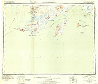
 1950 Hagemeister Island D-61957 Print · USGSCoastal mining and remote encampments define this mid-century look at the Alaskan shoreline. Trace the infrastructure of the Goodnews Mining Camp, including its Landing Strip, Ditch, and riverside tailings.
 - 1951 Map of Hagemeister Island, 1953 Print
 1951 Hagemeister Island1953 Print · USGSSouthwestern Alaska's coastal frontier is detailed in this mid-century reconnaissance, showing the territory before modern infrastructure. Researchers can trace the Winter Trail and locate coastal landmarks like Platinum, Hagemeister Island, and the Walrus Islands.2 unique versions available
 - 1957 Map of Hagemeister Island, 1966 Print
 1957 Hagemeister Island1966 Print · USGSCoastal Alaska's mining and maritime landscape comes alive in the mid-1950s, highlighting the remote settlements and rugged Bristol Bay shoreline. Researchers can trace the industrial footprint at Goodnews Mining Camp or locate coastal features like Cape Newenham and Kinegnak.3 unique versions available
 - 2018 Map of Hagemeister Island D-6 NE, 2018 Print
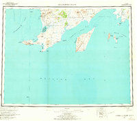
 2018 Hagemeister Island D-6 NE2018 Print · USGSMining and aviation infrastructure define this coastal area of the Bethel Census Area as it appeared in 2018. Researchers can trace the layout of Goodnews Mining Camp, the Platinum Mine Airport, and topographic landmarks like Red Mtn.
End of results
Showing maps 1-4 of 4
Top cities near Goodnews Mining Camp
Frequently asked questions
- What are the different types of historical maps available for Goodnews Mining Camp?
- What is the oldest map of Goodnews Mining Camp?
- Where can I purchase historical maps of Goodnews Mining Camp for my home or office?
- Where can I download high-res historical maps of Goodnews Mining Camp?
- Are there historical topographic maps available for Goodnews Mining Camp?
- Is there historical aerial imagery available for Goodnews Mining Camp?
- Where are historical maps of Goodnews Mining Camp sourced from?