Old Maps of Quinhagak, Alaska for Metal Detecting
Plan your next treasure hunt with 6 historic maps of Quinhagak. Find old homesites, ghost towns, trails, and gathering spots that may be lost to time — perfect for identifying promising metal detecting locations.
- Locate forgotten sites: Uncover places like long-lost settlements, abandoned rail lines, or gathering spots.
- Plan better hunts: Use map overlays combined with LiDAR or satellite views to narrow in on historically rich areas.
- Made for detectorists: Thousands of hobbyists use these maps to discover relics, coins, and hidden history.
Use these historic maps to boost your research and find new opportunities beneath the surface of Quinhagak.
Quinhagak, AK maps
(6)- 1951 Map of Goodnews, 1953 Print
 1951 Goodnews1953 Print · USGSSouthwest Alaska’s coastal bays and mountain lakes are captured here just after the war, showing the area's shifting settlement patterns. Trace the coastline from Kwinhagak to Goodnews, or locate interior landmarks like the Placer Mine and Nuyakuk Lake.6 unique versions available
 - 1954 Map of Goodnews D-8, 1968 Print
 1954 Goodnews D-81968 Print · USGSCoastal Alaska in the mid-1950s comes into focus along the eastern shores of Kuskokwim Bay near the settlement of Quinhagak. Trace early transportation routes like the Tractor Trail or follow the winding Kanektok River into the interior.2 unique versions available
 - 1954 Map of Goodnews C-8, 1969 Print
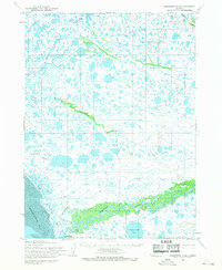
 1954 Goodnews C-81969 Print · USGSThe coastal tundra of Kuskokwim Bay is captured here in the mid-1950s, showing a land of tidal flats and seasonal trails. Researchers can trace the Winter Trail between the settlement of Quinhagak and the site of Arolik (Abandoned).2 unique versions available
 - 1979 Map of Goodnews Bay
 1979 Goodnews Bay1979 Print · USGSCoastal villages and massive mountain ranges define the southwestern Alaska wilderness during the late seventies. Researchers can trace remote routes like the Winter Trail and locate isolated outposts at Platinum and Goodnews Bay near Cape Newenham.2 unique versions available
 - 2017 Map of Goodnews Bay C-8 NW, 2017 Print
 2017 Goodnews Bay C-8 NW2017 Print · USGSQuinhagak and the surrounding coastal tundra of the Bethel Census Area are documented here in the early twenty-first century. Researchers can trace the village layout via Boardwalk and Fish Plant Road or follow the North Mouth Arolik River to the sea.
 - 2017 Map of Goodnews Bay D-8 SW, 2017 Print
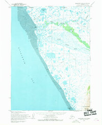
 2017 Goodnews Bay D-8 SW2017 Print · USGSThe coastal settlement of Quinhagak is captured in detail during the late twenty-teens, showing its vital position where the river meets the sea. Researchers can trace the winding course of the Kanektok River and locate local landmarks such as Quinhagak Airport and Stoggnang Cr.
End of results
Showing maps 1-6 of 6
Frequently asked questions
- What are the different types of historical maps available for Quinhagak?
- What is the oldest map of Quinhagak?
- Where can I purchase historical maps of Quinhagak for my home or office?
- Where can I download high-res historical maps of Quinhagak?
- Are there historical topographic maps available for Quinhagak?
- Is there historical aerial imagery available for Quinhagak?
- Where are historical maps of Quinhagak sourced from?