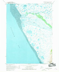
1954 Map of Goodnews C-8
USGS Topo · Published 1969About this map
Quinhagak anchors the northern coastline of this survey, where the delta environment meets the expansive Kuskokwim Bay. The landscape is defined by an intricate network of waterways and extensive tidal flats, indicating a region heavily influenced by the shifting tides and seasonal freeze. To the south, the North Mouth Arolik River and South Mouth Arolik River provide a primary drainage system for the inland tundra, punctuated by numerous bodies of water like Tsingigkalik Lake and Ithagsutlek Lake.
Find a feature on this map
20 named features on this map. Tap any name to fly to it.
Don’t see what you’re looking for? This feature index may not catch every label — zoom into the map to look around manually.
Map Details
Editions of this 1954 Goodnews C-8 Map
2 editions found
Other maps of this area

1951 · Kuskokwim Bay
USGS Topo · 1:250,000

1951 · Goodnews
USGS Topo · 1:250,000

1954 · Goodnews B-7
USGS Topo · 1:63,360

1954 · Kuskokwim Bay
USGS Topo · 1:250,000

1954 · Goodnews B-8
USGS Topo · 1:63,360

1954 · Goodnews C-7
USGS Topo · 1:63,360

1954 · Goodnews D-7
USGS Topo · 1:63,360
1954 · Goodnews D-8
USGS Topo · 1:63,360
1954 · Kuskokwim Bay D-1
USGS Topo · 1:63,360

1979 · Goodnews Bay
USGS Topo · 1:250,000