
1954 Map of Goodnews B-8
USGS Topo · Published 1968About this map
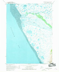
Kuskokwim Bay and the tidal flats of the Bering Sea coast define the western edge of this mid-century survey. The landscape transitions from the expansive waters of Jacksmith Bay and Carter Bay into a complex network of coastal wetlands and meandering waterways like the Indian River. Evidence of seasonal movement and human activity is sparse but clear, marked by a single Cabin and the route of the Winter Trail cutting through the interior towards the shoreline. To the east, the terrain rises sharply into a series of prominent peaks, including Twin Mountain, Cone Mountain, and Tooth Mountain. These summits overlook a system of drainage basins such as Figure Four Creek and Jacksmith Creek, which flow from the higher elevations of South Yoke Mountain toward the sea, illustrating the watershed patterns of this coastal environment during the 1950s.
Find a feature on this map
21 named features on this map. Tap any name to fly to it.
Don’t see what you’re looking for? This feature index may not catch every label — zoom into the map to look around manually.
Map Details
Editions of this 1954 Goodnews B-8 Map
This is the sole edition of this map. No revisions or reprints were ever made.
Other maps of this area

1951 · Kuskokwim Bay
USGS Topo · 1:250,000

1951 · Goodnews
USGS Topo · 1:250,000

1954 · Goodnews A-8
USGS Topo · 1:63,360

1954 · Goodnews B-7
USGS Topo · 1:63,360

1954 · Goodnews A-7
USGS Topo · 1:63,360

1954 · Kuskokwim Bay
USGS Topo · 1:250,000

1954 · Goodnews C-7
USGS Topo · 1:63,360
1954 · Goodnews C-8
USGS Topo · 1:63,360

1979 · Goodnews Bay
USGS Topo · 1:250,000
2017 · Goodnews Bay B-8 SE
USGS Topo · 1:25,000