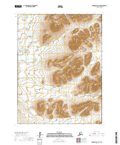
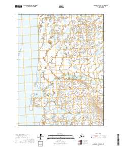
2017 Map of Goodnews Bay B-8 SE
USGS Topo · Published 2017About this map
The Ahklun Mountains dominate the eastern landscape of this remote portion of the Bethel Census Area, where sharp peaks and glacial drainages define the wilderness character. Distinctive summits such as Cone Mtn and Tooth Mtn rise above the complex network of the N Fork Indian River and its various tributaries. The hydrology of the region is intricately mapped, showing the seasonal flow of Cripple Cr and Nautilus Cr as they weave through the high-elevation terrain. This survey illustrates the uninhabited, roadless nature of the Goodnews Bay region in the early 21st century, where the land is primarily divided by the Public Land Survey System grids, including t10s r74w and t11s r73w, rather than human settlements or infrastructure.
Find a feature on this map
14 named features on this map. Tap any name to fly to it.
Don’t see what you’re looking for? This feature index may not catch every label — zoom into the map to look around manually.
Map Details
Editions of this 2017 Goodnews Bay B-8 SE Map
This is the sole edition of this map. No revisions or reprints were ever made.
Other maps of this area

1951 · Goodnews
USGS Topo · 1:250,000

1954 · Goodnews A-8
USGS Topo · 1:63,360

1954 · Goodnews B-7
USGS Topo · 1:63,360

1954 · Goodnews A-7
USGS Topo · 1:63,360

1954 · Goodnews B-8
USGS Topo · 1:63,360

1979 · Goodnews Bay
USGS Topo · 1:250,000
2017 · Goodnews Bay B-8 NW
USGS Topo · 1:25,000
2017 · Goodnews Bay B-7 NW
USGS Topo · 1:25,000
2017 · Goodnews Bay B-8 NE
USGS Topo · 1:25,000
2017 · Goodnews Bay B-8 SW
USGS Topo · 1:25,000