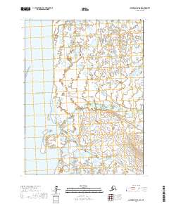
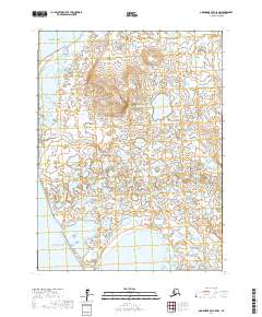
2017 Map of Goodnews Bay B-8 SW
USGS Topo · Published 2017About this map
The Pacific Ocean coastline dominates the western edge of this coastal reach, where a low-lying landscape is defined by the shifting meeting of salt water and fresh water drainage. The Indian River system serves as the primary hydrological feature, branching into the N Fork Indian River and S Fork Indian River as it traverses the wetlands. Further south, the drainage of Carter Cr winds through the flats toward the shore. This 2017 survey by the U.S. Geological Survey illustrates a remote maritime environment where the lack of established roads or settlements highlights the isolation of this portion of the Bethel Census Area. The intricate network of small ponds and unnamed water bodies between the river forks indicates a complex, saturated terrain where the landscape changes with the tides and seasonal flow.
Find a feature on this map
11 named features on this map. Tap any name to fly to it.
Don’t see what you’re looking for? This feature index may not catch every label — zoom into the map to look around manually.
Map Details
Editions of this 2017 Goodnews Bay B-8 SW Map
This is the sole edition of this map. No revisions or reprints were ever made.
Other maps of this area

1951 · Kuskokwim Bay
USGS Topo · 1:250,000

1951 · Goodnews
USGS Topo · 1:250,000

1954 · Goodnews A-8
USGS Topo · 1:63,360

1954 · Kuskokwim Bay
USGS Topo · 1:250,000

1954 · Goodnews B-8
USGS Topo · 1:63,360

1979 · Goodnews Bay
USGS Topo · 1:250,000
2017 · Goodnews Bay B-8 SE
USGS Topo · 1:25,000
2017 · Goodnews Bay B-8 NW
USGS Topo · 1:25,000
2017 · Goodnews Bay B-8 NE
USGS Topo · 1:25,000
2017 · Goodnews Bay A-8 NW
USGS Topo · 1:25,000