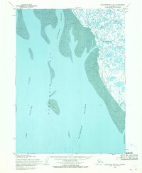
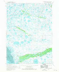
1954 Map of Kuskokwim Bay D-1
USGS Topo · Published 1969About this map
Kuskokwim Bay and its intricate network of tidal waterways dominate this mid-century topographic survey, documenting a coastline defined by shifting silts and seasonal travel. The landscape is marked by a vast Tidal Flat and the deep incisions of the Kuskokwak Channel and Eek Channel. Human presence is sparse but strategic, anchored by Warehouse and a solitary Cabin located near the mouth of Warehouse Creek. This area served as a critical interface between the open bay and the interior, where a Winter Trail hugs the coast along Warehouse Bluff. These seasonal routes were essential for regional movement when the marshy terrain and numerous tributaries, such as Tundak Creek and Weekeng Cr, were frozen. The map reflects a period of transition as the Army Map Service used aerial photogrammetry to chart this remote Alaskan shoreline.
Find a feature on this map
12 named features on this map. Tap any name to fly to it.
Don’t see what you’re looking for? This feature index may not catch every label — zoom into the map to look around manually.
Map Details
Editions of this 1954 Kuskokwim Bay D-1 Map
This is the sole edition of this map. No revisions or reprints were ever made.
Other maps of this area

1950 · Bethel
USGS Topo · 1:250,000

1951 · Kuskokwim Bay
USGS Topo · 1:250,000

1951 · Goodnews
USGS Topo · 1:250,000

1951 · Baird Inlet
USGS Topo · 1:250,000
1953 · Kuskokwim Bay D-2
USGS Topo · 1:63,360
1954 · Bethel A-8
USGS Topo · 1:63,360

1954 · Baird Inlet
USGS Topo · 1:250,000

1954 · Kuskokwim Bay
USGS Topo · 1:250,000
1954 · Baird Inlet A-1
USGS Topo · 1:63,360
1954 · Goodnews D-8
USGS Topo · 1:63,360