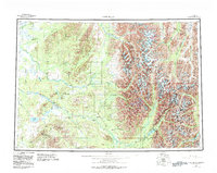
1958 Map of Lime Hills
USGS Topo · Published 1983About this map
The Revelation Mountains dominate this region of interior Alaska, where the landscape is defined by the complex drainage systems of the Stony River and Swift River. In the mid-20th century, human presence was concentrated in the isolated settlement of Lime Village and the high-altitude Sparrevohn Air Force Station. The map illustrates a dramatic transition from the low-lying wetlands around Tundra Lake and Salmon Berry Lake to the towering peaks of the Neacola Mountains. The intricate network of forks and creeks, including the South Fork Big River and Hartman River, reveals the topographical barriers that historically shaped movement through this wilderness. This edition also captures the early boundaries of Lake Clark National Park and Preserve and Denali National Park and Preserve, marking a period of increasing federal land management in the Alaskan interior.
Find a feature on this map
58 named features on this map. Tap any name to fly to it.
Don’t see what you’re looking for? This feature index may not catch every label — zoom into the map to look around manually.
Map Details
Editions of this 1958 Lime Hills Map
3 editions found

Other maps of this area

1944 · Kenai
USGS Topo · 1:250,000

1946 · Lake Clark
USGS Topo · 1:250,000

1949 · Tyonek
USGS Topo · 1:250,000

1949 · McGrath
USGS Topo · 1:250,000

1950 · Kenai
USGS Topo · 1:250,000

1950 · Sleetmute
USGS Topo · 1:250,000

1950 · McGrath
USGS Topo · 1:250,000

1950 · Talkeetna
USGS Topo · 1:250,000

1950 · Taylor Mountains
USGS Topo · 1:250,000

1951 · Talkeetna
USGS Topo · 1:250,000