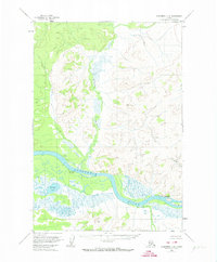
1954 Map of Sleetmute C-8
USGS Topo · Published 1974About this map
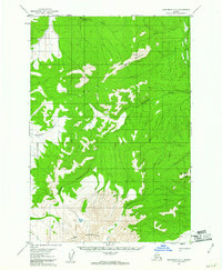
The Kuskokwim River carves a massive, winding path through this mid-century landscape, flanked by a network of expansive wetlands and seasonal drainage systems. Near the river's bend lies the Kolmakof (Site), a location of significant historical weight as a former Russian trading post, appearing here alongside the Kolmakof River and the nearby Kolmakof Lake. These features, along with the settlement of Napaimiut further downstream, highlight a geography where life and transport were dictated entirely by water. Small tributary systems such as New York Creek and Suter Creek feed into the main channel, while the presence of a Landing Area and scattered Cabins suggests the sparse, functional infrastructure required for survival and commerce in the Alaskan interior during the 1950s.
Find a feature on this map
11 named features on this map. Tap any name to fly to it.
Don’t see what you’re looking for? This feature index may not catch every label — zoom into the map to look around manually.
Map Details
Editions of this 1954 Sleetmute C-8 Map
2 editions found
Other maps of this area

1947 · Russian Mission
USGS Topo · 1:250,000

1950 · Russian Mission
USGS Topo · 1:250,000

1950 · Sleetmute
USGS Topo · 1:250,000

1952 · Russian Mission C-1
USGS Topo · 1:63,360

1952 · Russian Mission D-1
USGS Topo · 1:63,360
1952 · Russian Mission B-1
USGS Topo · 1:63,360
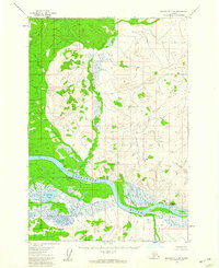
1954 · Sleetmute C-8
USGS Topo · 1:63,360
1954 · Sleetmute D-8
USGS Topo · 1:63,360
1954 · Sleetmute D-7
USGS Topo · 1:63,360

1954 · Sleetmute
USGS Topo · 1:250,000