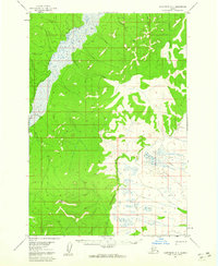
1954 Map of Sleetmute D-8
USGS Topo · Published 1960About this map
The Iditarod River and Kolmakof River dominate this interior landscape, which was documented by the Geological Survey during the mid-1950s. The terrain transitions from the low-lying wetland drainage of the Iditarod in the west to the higher, creek-carved elevations to the east. Navigability and seasonal movement are central to the geography here, evidenced by the Winter Trail cutting through the river valley. This route likely served as a critical passage for mail and freight when the ground was frozen. Tributaries like Quinn Creek, Rainy Creek, and Little Creek feed the larger river systems, defining the drainage patterns of the Seward Meridian. Surveyors marked the elevation at VABM East Base 1010, providing a rare fixed landmark in this sparsely labeled stretch of the Alaskan interior.
Find a feature on this map
8 named features on this map. Tap any name to fly to it.
Don’t see what you’re looking for? This feature index may not catch every label — zoom into the map to look around manually.
Map Details
Editions of this 1954 Sleetmute D-8 Map
2 editions found
Other maps of this area

1947 · Russian Mission
USGS Topo · 1:250,000

1950 · Russian Mission
USGS Topo · 1:250,000

1950 · Sleetmute
USGS Topo · 1:250,000

1951 · Holy Cross
USGS Topo · 1:250,000

1951 · Iditarod
USGS Topo · 1:250,000

1952 · Holy Cross A-1
USGS Topo · 1:63,360

1952 · Russian Mission C-1
USGS Topo · 1:63,360

1952 · Holy Cross
USGS Topo · 1:250,000

1952 · Russian Mission D-1
USGS Topo · 1:63,360
1954 · Sleetmute C-8
USGS Topo · 1:63,360