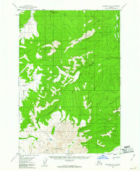
1954 Map of Sleetmute D-7
USGS Topo · Published 1961About this map
Juninggulra Mountain and the Horn Mountains dominate this 1950s interior landscape, where mineral exploration left distinct marks upon the terrain. Evidence of industry is visible near the summit of Juninggulra, where Mine Dumps and a dedicated Landing Area suggest active mining operations at the time of the survey. A primitive Tractor Trail provides the only overland route through the drainage basins of the Montana Creek and Eagle Creek.
Find a feature on this map
13 named features on this map. Tap any name to fly to it.
Don’t see what you’re looking for? This feature index may not catch every label — zoom into the map to look around manually.
Map Details
Editions of this 1954 Sleetmute D-7 Map
2 editions found
Other maps of this area

1950 · Sleetmute
USGS Topo · 1:250,000

1951 · Iditarod
USGS Topo · 1:250,000
1954 · Sleetmute C-8
USGS Topo · 1:63,360
1954 · Sleetmute D-8
USGS Topo · 1:63,360

1954 · Sleetmute D-6
USGS Topo · 1:63,360

1954 · Iditarod A-6
USGS Topo · 1:63,360

1954 · Iditarod A-5
USGS Topo · 1:63,360

1954 · Sleetmute C-6
USGS Topo · 1:63,360

1954 · Sleetmute
USGS Topo · 1:250,000

1956 · Iditarod
USGS Topo · 1:250,000