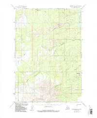
1954 Map of Sleetmute D-7
USGS Topo · Published 1987About this map
Horn Mountains dominate the southern portion of this interior Alaskan landscape, providing a dramatic backdrop to a network of drainage systems. The survey reveals a region defined by its watercourses, including the westward-flowing Kolmakof River and the winding Getmuna Creek. Evidence of mid-century aviation and transit is visible near Juninggulra Mountain, where a Landing Strip is positioned to serve this isolated terrain.
Find a feature on this map
18 named features on this map. Tap any name to fly to it.
Don’t see what you’re looking for? This feature index may not catch every label — zoom into the map to look around manually.
Map Details
Editions of this 1954 Sleetmute D-7 Map
2 editions found
Other maps of this area

1950 · Sleetmute
USGS Topo · 1:250,000

1951 · Iditarod
USGS Topo · 1:250,000
1954 · Sleetmute C-8
USGS Topo · 1:63,360
1954 · Sleetmute D-8
USGS Topo · 1:63,360

1954 · Sleetmute D-6
USGS Topo · 1:63,360
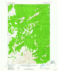
1954 · Sleetmute D-7
USGS Topo · 1:63,360

1954 · Iditarod A-6
USGS Topo · 1:63,360

1954 · Iditarod A-5
USGS Topo · 1:63,360

1954 · Sleetmute C-6
USGS Topo · 1:63,360

1954 · Sleetmute
USGS Topo · 1:250,000