
1954 Map of Sleetmute C-6
USGS Topo · Published 1966About this map
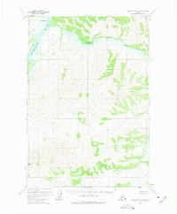
The Kuskokwim River defines the northwest corner of this 1950s interior landscape, where the seasonal and subsistence patterns of the region are evident through isolated markers of human presence. The small settlement of Oskawalik sits at the confluence where the Oskawalik River meets the larger Kuskokwim, serving as a primary point of reference in a terrain dominated by drainage systems and high ridges. Evidence of wilderness travel and resource storage is preserved through labels for a Cabin and Caches along the riverbanks, representing the essential infrastructure of mid-century life in the Bethel region. Further south, the topography rises sharply toward the summit of Aghaluk Mtn, providing a stark contrast to the low-lying river valleys and complex marshy sections mapped during this mid-century survey.
Find a feature on this map
6 named features on this map. Tap any name to fly to it.
Don’t see what you’re looking for? This feature index may not catch every label — zoom into the map to look around manually.
Map Details
Editions of this 1954 Sleetmute C-6 Map
2 editions found
Other maps of this area

1950 · Sleetmute
USGS Topo · 1:250,000

1954 · Sleetmute D-5
USGS Topo · 1:63,360

1954 · Sleetmute D-6
USGS Topo · 1:63,360
1954 · Sleetmute D-7
USGS Topo · 1:63,360

1954 · Sleetmute C-5
USGS Topo · 1:63,360

1954 · Sleetmute
USGS Topo · 1:250,000

1954 · Sleetmute B-5
USGS Topo · 1:63,360

1954 · Sleetmute B-6
USGS Topo · 1:63,360

1954 · Sleetmute B-7
USGS Topo · 1:63,360
1957 · Sleetmute C-7
USGS Topo · 1:63,360