
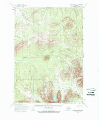
1954 Map of Sleetmute B-6
USGS Topo · Published 1968About this map
The Chulnuk Mountains and Kiokluk Mountains dominate this 1954 topographic survey, representing a period when vast sections of the Seward Meridian remained unsurveyed and unmarked on the ground. Compiled from 1953 aerial photography by the Army Map Service, the landscape is defined by a complex network of high ridges and drainage basins. Holokuk Mountain stands as a prominent landmark in the northwest, while the waters of Chineekluk Creek and Kiokluk Creek carve through the deep valleys between the peaks. The map detail reflects the pre-development state of the Alaskan interior, showing no established roads or trails. Instead, the geography is dictated by natural corridors like Portage Creek and Veehna Creek, which served as the primary navigation markers for travelers and surveyors in this wilderness during the mid-twentieth century.
Find a feature on this map
9 named features on this map. Tap any name to fly to it.
Don’t see what you’re looking for? This feature index may not catch every label — zoom into the map to look around manually.
Map Details
Editions of this 1954 Sleetmute B-6 Map
2 editions found
Other maps of this area

1950 · Sleetmute
USGS Topo · 1:250,000

1954 · Sleetmute C-6
USGS Topo · 1:63,360

1954 · Sleetmute C-5
USGS Topo · 1:63,360

1954 · Sleetmute
USGS Topo · 1:250,000

1954 · Sleetmute A-5
USGS Topo · 1:63,360

1954 · Sleetmute A-7
USGS Topo · 1:63,360

1954 · Sleetmute B-5
USGS Topo · 1:63,360

1954 · Sleetmute A-6
USGS Topo · 1:63,360

1954 · Sleetmute B-7
USGS Topo · 1:63,360
1957 · Sleetmute C-7
USGS Topo · 1:63,360