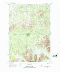
1954 Map of Sleetmute B-6
USGS Topo · Published 1968About this map
Chuilnuk Mountains and the Kiokluk Mountains dominate this 1954 topographic survey, representing a remote interior Alaskan landscape at the mid-century. Mapped by the Army Map Service using aerial photography from 1953, the area is defined by its complex drainage systems and high peaks, including Holokuk Mountain and Chineekluk Mountain. Significant watercourses such as Chineekluk Creek and Kiokluk Creek flow through the valleys, while Portage Creek cuts through the southeastern high ground. The lack of roads or trails noted in the margin highlights the wilderness character of this region during the post-war era of territorial mapping. Geologists and local historians can use this survey to examine the natural hydrology and topographical contours before later developments or environmental shifts altered the drainage patterns of Veahna Creek and Beemguiga Creek.
Find a feature on this map
9 named features on this map. Tap any name to fly to it.
Don’t see what you’re looking for? This feature index may not catch every label — zoom into the map to look around manually.
Map Details
Editions of this 1954 Sleetmute B-6 Map
2 editions found
Other maps of this area

1950 · Sleetmute
USGS Topo · 1:250,000

1954 · Sleetmute C-6
USGS Topo · 1:63,360

1954 · Sleetmute C-5
USGS Topo · 1:63,360

1954 · Sleetmute
USGS Topo · 1:250,000

1954 · Sleetmute A-5
USGS Topo · 1:63,360

1954 · Sleetmute A-7
USGS Topo · 1:63,360

1954 · Sleetmute B-5
USGS Topo · 1:63,360

1954 · Sleetmute A-6
USGS Topo · 1:63,360

1954 · Sleetmute B-6
USGS Topo · 1:63,360

1954 · Sleetmute B-7
USGS Topo · 1:63,360