
1952 Map of Russian Mission B-8
USGS Topo · Published 1962About this map
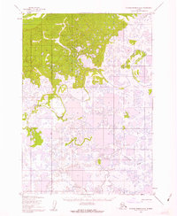
The sprawling marshlands and intricate waterways of the Yukon-Kuskokwim Delta are captured in this 1952 study. The landscape is dominated by the meandering course of the Johnson River, which winds through a dense network of countless unnamed tundra lakes and ponds. In the southern portion of the sheet, the Kvichavak River cuts through the low-lying terrain, illustrating the complex hydrologic patterns of this Alaskan subregion. This topographical record was produced primarily through photogrammetric methods from aerial photographs, as much of the area remained unsurveyed and unmarked on the ground at the time. The transition from the northern uplands into the water-heavy delta plains highlights the shifting geography that has historically dictated travel and subsistence patterns for the region's inhabitants.
Find a feature on this map
2 named features on this map. Tap any name to fly to it.
Don’t see what you’re looking for? This feature index may not catch every label — zoom into the map to look around manually.
Map Details
Editions of this 1952 Russian Mission B-8 Map
2 editions found
Other maps of this area

1947 · Russian Mission
USGS Topo · 1:250,000

1950 · Russian Mission
USGS Topo · 1:250,000

1951 · Marshall
USGS Topo · 1:250,000

1952 · Russian Mission C-8
USGS Topo · 1:63,360
1952 · Russian Mission C-7
USGS Topo · 1:63,360
1952 · Russian Mission B-7
USGS Topo · 1:63,360

1952 · Marshall C-1
USGS Topo · 1:63,360

1954 · Russian Mission A-8
USGS Topo · 1:63,360
1954 · Russian Mission A-7
USGS Topo · 1:63,360

1954 · Marshall A-1
USGS Topo · 1:63,360