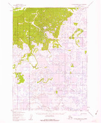
1952 Map of Russian Mission B-8
USGS Topo · Published 1962About this map
The low-lying tundra and wetland landscape of the Seward Meridian appears in this early 1950s survey, dominated by a complex network of meandering waterways and countless thermokarst lakes. The Johnson River snakes through the central and northern sections of the sheet, exhibiting the characteristic oxbows and intricate drainage patterns of the Yukon-Kuskokwim Delta. To the south, the Kvichavak River winds across the alluvial plain, illustrating the fluid nature of this environment before modern development. Mapped primarily through photogrammetric methods from aerial photographs, this document captures a vast, roadless wilderness where the river systems served as the primary corridors for movement and seasonal subsistence. The transition between the wooded areas in the north and the increasingly saturated marshlands to the south highlights the specific geomorphology of this subarctic region during the mid-twentieth century.
Find a feature on this map
2 named features on this map. Tap any name to fly to it.
Don’t see what you’re looking for? This feature index may not catch every label — zoom into the map to look around manually.
Map Details
Editions of this 1952 Russian Mission B-8 Map
2 editions found
Other maps of this area

1947 · Russian Mission
USGS Topo · 1:250,000

1950 · Russian Mission
USGS Topo · 1:250,000

1951 · Marshall
USGS Topo · 1:250,000

1952 · Russian Mission C-8
USGS Topo · 1:63,360
1952 · Russian Mission C-7
USGS Topo · 1:63,360
1952 · Russian Mission B-7
USGS Topo · 1:63,360

1952 · Russian Mission B-8
USGS Topo · 1:63,360

1952 · Marshall C-1
USGS Topo · 1:63,360

1954 · Russian Mission A-8
USGS Topo · 1:63,360
1954 · Russian Mission A-7
USGS Topo · 1:63,360