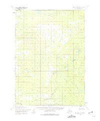
1954 Map of Lime Hills B-5
USGS Topo · Published 1975About this map
Stony River and the Swift R anchor this mid-century topographic record of the Lime Hills region. The landscape is defined by the winding course of Little Underhill Creek, which meanders through a territory punctuated by distinct high points such as Anchor, Center, and Caribou. This 1950s survey, compiled from aerial photography, illustrates the hydrological network and elevation profiles before modern changes or developments reached this interior portion of Alaska. The map reflects a moment when mapping agencies focused on documenting the intricate drainage patterns and prominent terrain features essential for wilderness navigation and resource planning.
Find a feature on this map
6 named features on this map. Tap any name to fly to it.
Don’t see what you’re looking for? This feature index may not catch every label — zoom into the map to look around manually.
Map Details
Editions of this 1954 Lime Hills B-5 Map
2 editions found
Other maps of this area

1951 · Lime Hills
USGS Topo · 1:250,000

1954 · Lime Hills C-6
USGS Topo · 1:63,360
1954 · Lime Hills C-5
USGS Topo · 1:63,360

1954 · Lime Hills A-5
USGS Topo · 1:63,360

1954 · Lime Hills B-4
USGS Topo · 1:63,360

1954 · Lime Hills A-4
USGS Topo · 1:63,360

1954 · Lime Hills B-5
USGS Topo · 1:63,360

1954 · Lime Hills A-6
USGS Topo · 1:63,360

1954 · Lime Hills B-6
USGS Topo · 1:63,360

1958 · Lime Hills C-4
USGS Topo · 1:63,360