
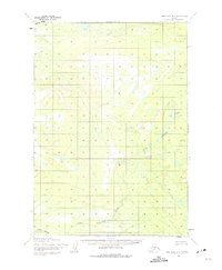
1954 Map of Lime Hills B-5
USGS Topo · Published 1965About this map
Stony River and Little Underhill Creek define the drainage patterns of this interior Alaskan wilderness during the mid-1950s. The landscape is dominated by complex topography, including the prominence of Anchor and the flow of the Swift R at the northern edge. At the time of this mapping, the region was characterized by unsurveyed and unmarked land lines as predetermined by the Bureau of Land Management, reflecting the remote nature of the territory before modern infrastructure. This 1:63,360 scale study provides a precise record of the natural hydrology and elevation contours across the Lime Hills area, documenting a period when the terrain remained largely untouched by permanent roads or settlements.
Find a feature on this map
4 named features on this map. Tap any name to fly to it.
Don’t see what you’re looking for? This feature index may not catch every label — zoom into the map to look around manually.
Map Details
Editions of this 1954 Lime Hills B-5 Map
2 editions found
Other maps of this area

1951 · Lime Hills
USGS Topo · 1:250,000

1954 · Lime Hills C-6
USGS Topo · 1:63,360
1954 · Lime Hills C-5
USGS Topo · 1:63,360

1954 · Lime Hills A-5
USGS Topo · 1:63,360

1954 · Lime Hills B-4
USGS Topo · 1:63,360

1954 · Lime Hills A-4
USGS Topo · 1:63,360

1954 · Lime Hills A-6
USGS Topo · 1:63,360

1954 · Lime Hills B-6
USGS Topo · 1:63,360

1958 · Lime Hills C-4
USGS Topo · 1:63,360

1958 · Lime Hills
USGS Topo · 1:250,000