
1958 Map of Lime Hills C-4
USGS Topo · Published 1966About this map
Glacial ice and high-altitude terrain dominate this 1950s environment, where the South Buttress stands as a primary landmark amidst a landscape of unnamed peaks and ridges. The drainage system is defined by the Swift River and its major tributary, the North Fork Swift River, which cut through the southwestern and central portions of the quadrangle. These waterways are fed by numerous meltwater streams and are surrounded by large areas of marshland and muskeg in the lower elevations. Because much of the territory remained unsurveyed and unmarked at the time of this mapping, the land lines provided by the Bureau of Land Management were predetermined based on the Seward Meridian rather than ground-level verification. The result is a study of a largely untouched Alaskan wilderness in the mid-20th century, where topography was still being meticulously recorded through photogrammetric methods from aerial photographs taken in 1954 and 1957.
Find a feature on this map
3 named features on this map. Tap any name to fly to it.
Don’t see what you’re looking for? This feature index may not catch every label — zoom into the map to look around manually.
Map Details
Editions of this 1958 Lime Hills C-4 Map
This is the sole edition of this map. No revisions or reprints were ever made.
Other maps of this area

1951 · Lime Hills
USGS Topo · 1:250,000

1954 · Lime Hills D-5
USGS Topo · 1:63,360
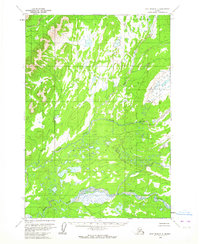
1954 · Lime Hills C-5
USGS Topo · 1:63,360

1954 · Lime Hills B-4
USGS Topo · 1:63,360

1954 · Lime Hills B-5
USGS Topo · 1:63,360

1954 · Lime Hills B-3
USGS Topo · 1:63,360

1958 · Lime Hills C-3
USGS Topo · 1:63,360

1958 · Lime Hills D-3
USGS Topo · 1:63,360
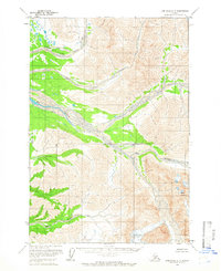
1958 · Lime Hills D-4
USGS Topo · 1:63,360

1958 · Lime Hills
USGS Topo · 1:250,000